
The worlds largest salt flats
Following our stay in Mendoza, we made our way northwards, crossing over the Argentinian border into Bolivia. Bolivia, a land-locked country in central South America, is split into the low-lands Amazon and the high-lands Andes regions. Our next goal was to get to Salar de Uyuni. However, as the PC-24 plane was lacking the necessary certification, we were unable to land at an altitude of 3600 meters above sea level. Therefore, we flew to Cochabamba, the third largest Bolivian City, at the start of the Western Andes.
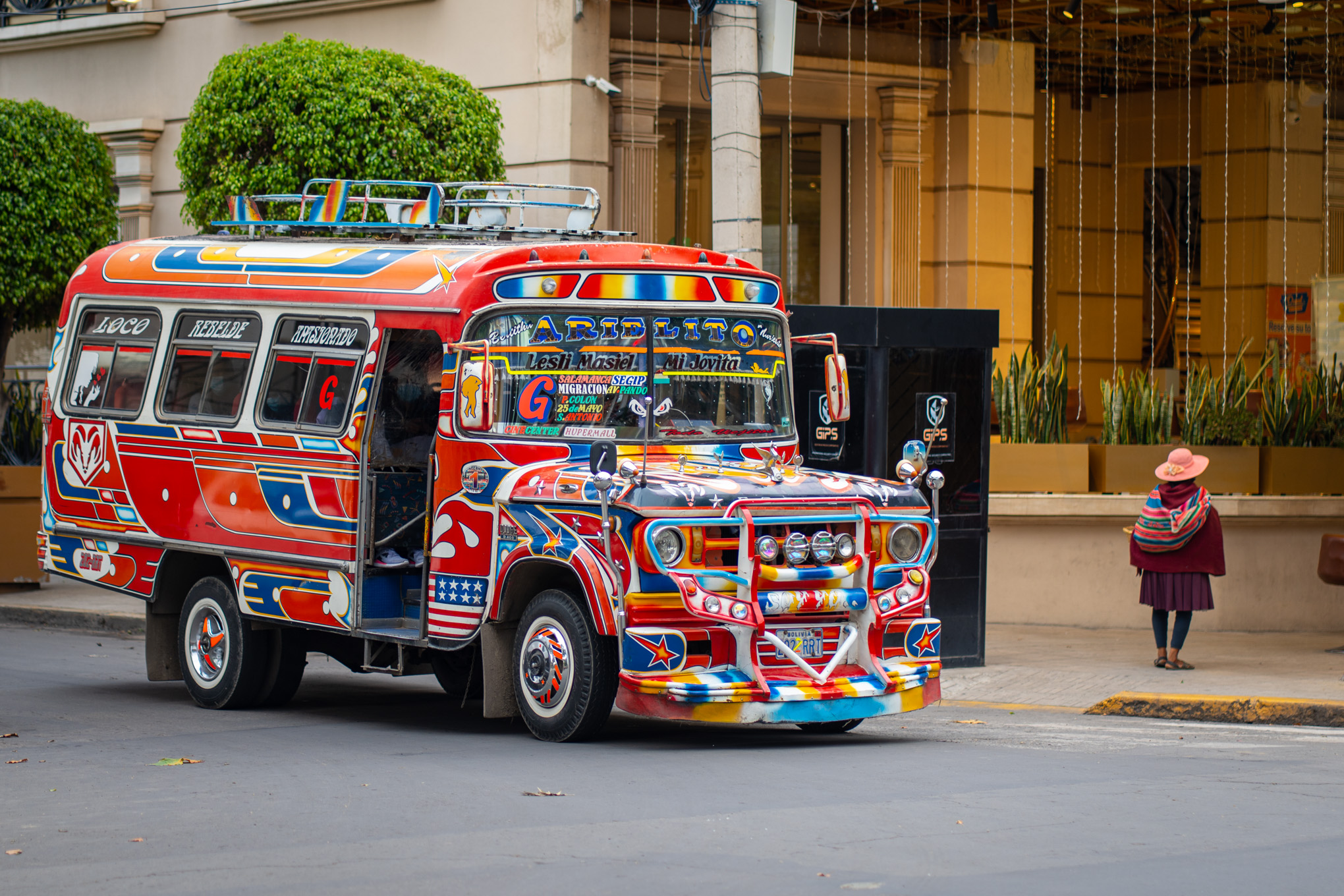
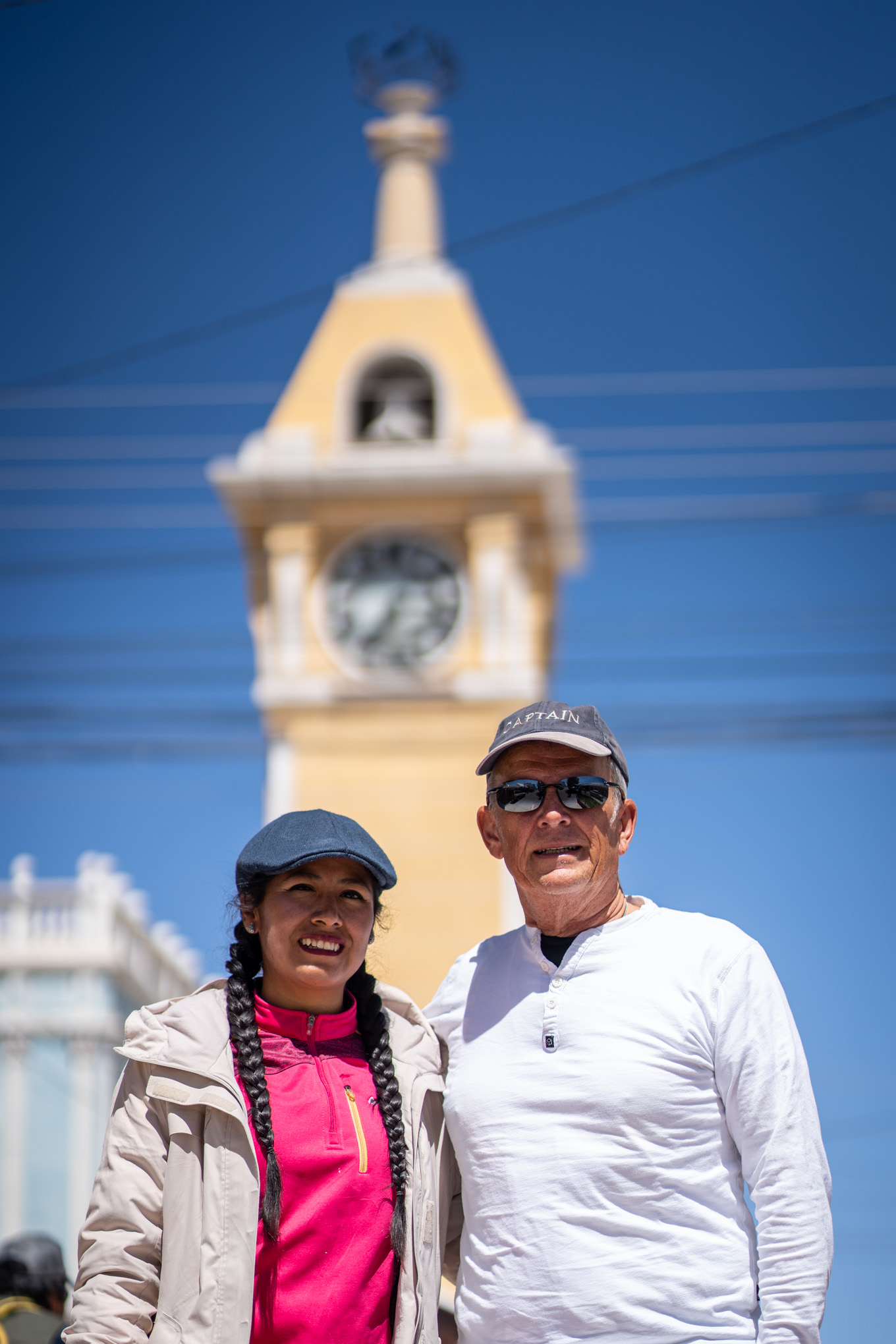
Similar to Cedric a couple of days prior, I was allowed to also have a small go at flying the PC-24. As a first flying experience, it was a lot of fun. After a 2h30 flight, and a comfortable landing by the Pilots, we arrived in Cochabamba. We quickly covered the plane, crossed immigration and got on our way to the hotel. We had lunch at a place close-by, which also happened to be some of the best food we had on this trip. A full steak meal (400g+) per person, as well as sides and drinks, set us back a combined 35 USD. Not only was it excellent, it was also very well cheap for our standards (although it is worth noting that the steak itself was the equivalent of the average Bolivian daily salary…). In the afternoon, Tom and I explored some parts of the city while RMF rested. It was interesting to see, but the city did not offer much, and it was evident that Bolivia is one of the poorer countries in South America. As such, we visited the Cristo de la Concordia (a giant Jesus Statue), and the main square before returning to the hotel. We ended the day playing cards in the evening (the first time on the last two trips) for a couple of hours.
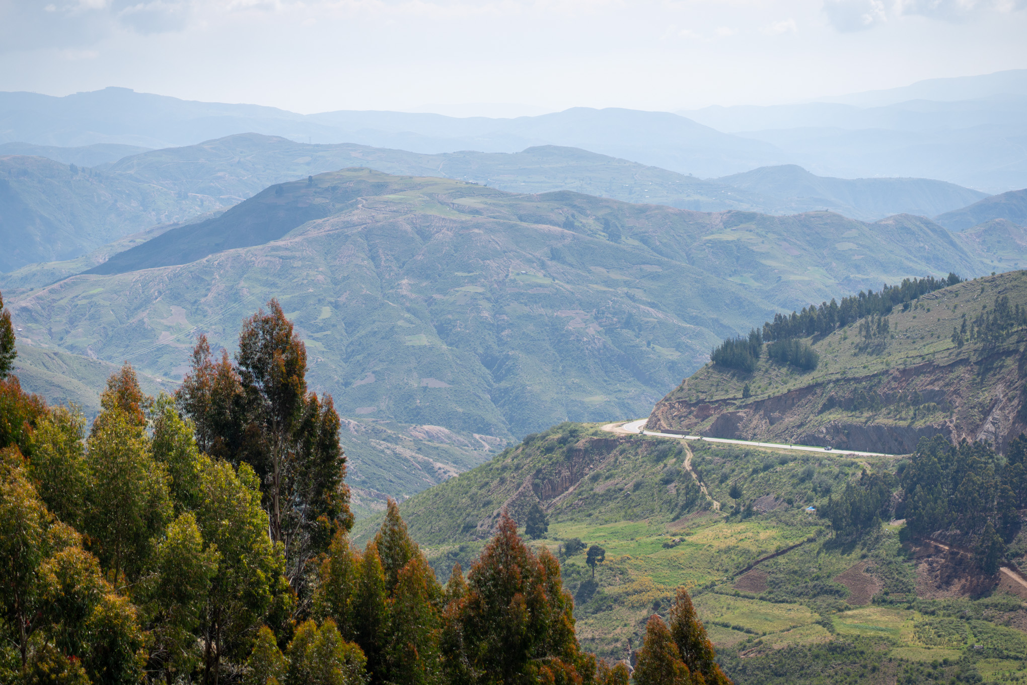
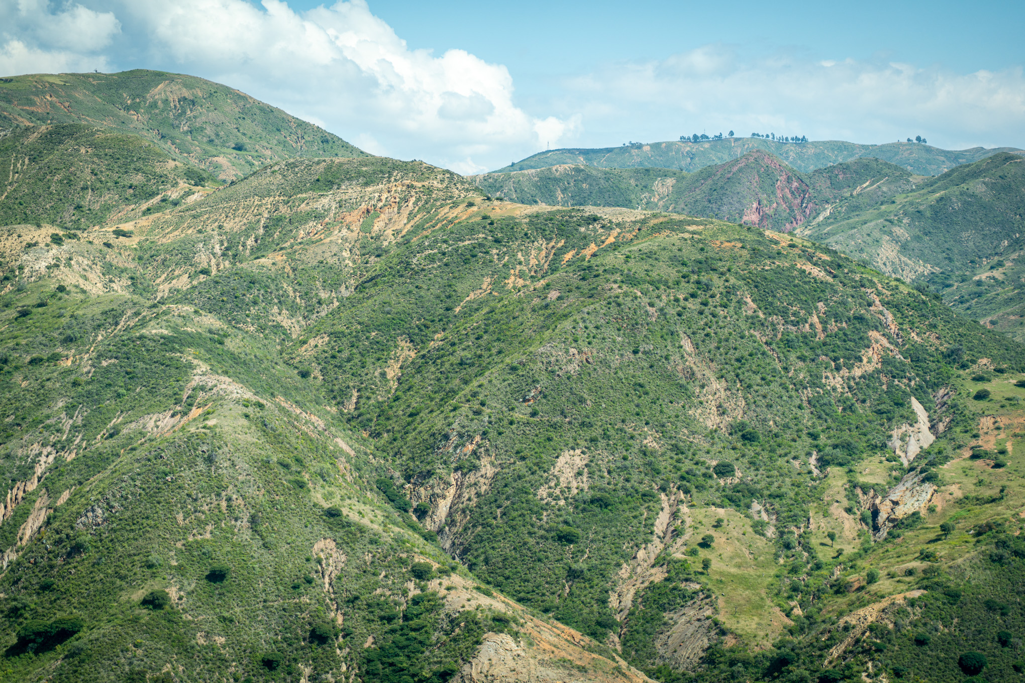
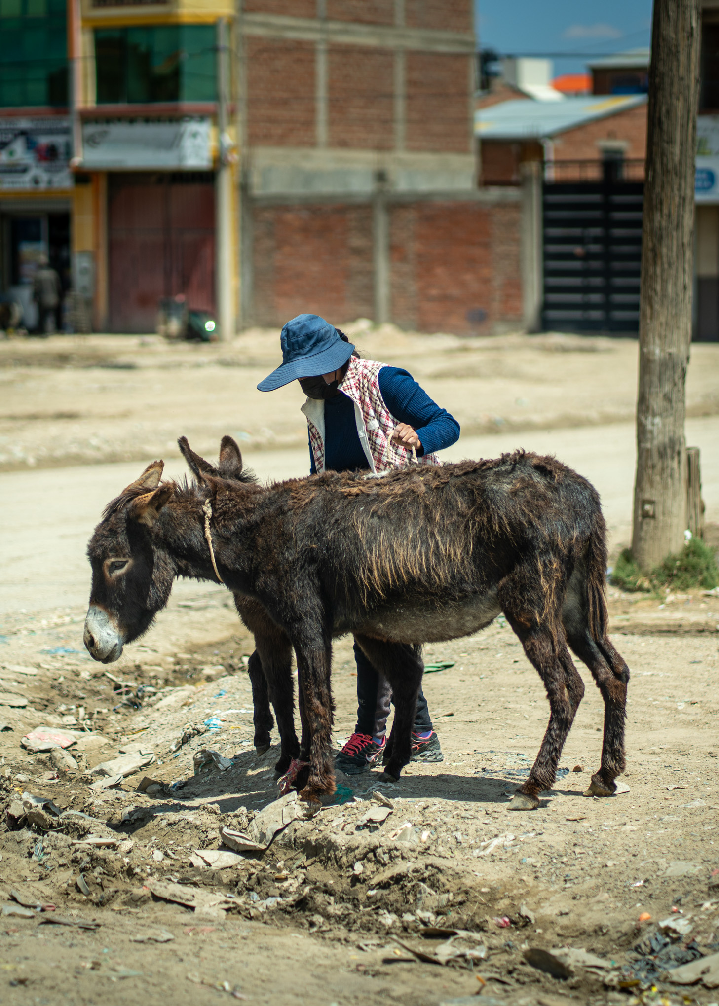
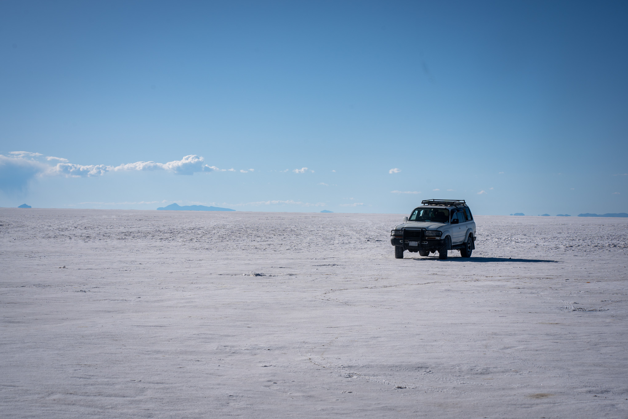
The next day, we made the 550km drive to Uyuni. The first hour of our journey was eaten up by traffic within Cochabamba. As we exited the centre of the city, a decrease in developmental standard became quite noticeable. Next up was a mountain pass that we had to clear in order to get to the high plateaus, on which Uyuni was. The streets up the pass were narrow, and quite dangerous. On the way we saw many stray dogs, a couple of small villages and lots of trucks, many of which had broken down. The driver made a couple of questionable overtaking manoeuvre but we managed to make our way to the top of the pass. I also noticed the countless roadside raves, in memory of roadside accidents, which made it clear that this drive was the most dangerous experience of our trip… At 4’400 meters above sea level, we got out, took a picture and continued onwards. We passed the town of Oruro, the first town on the high plateau. The town was clearly still developing, and reminiscent of similar sized settlements in Africa. We passed through and had smooth sailing on the last 3500km to Uyuni.
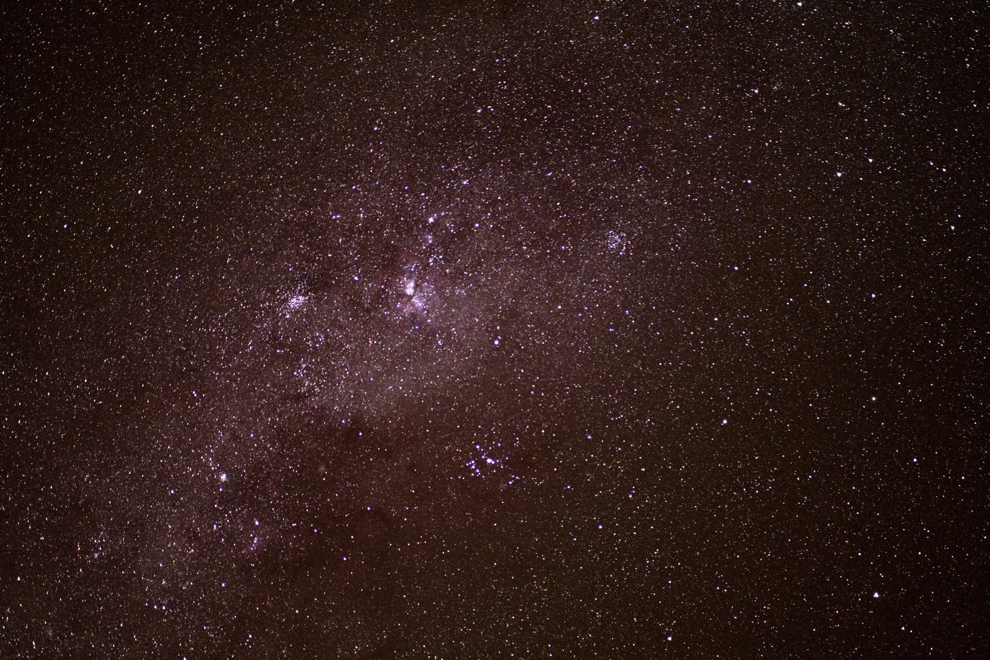
We arrived in the afternoon, exhausted and happy to get out of the car and stretch our legs after sitting for 9h. We would have arrived earlier, but the driver initially also missed the exit by about 20km, so we did a little extra round. Following our dinner, we went out for a quick stargazing tour on the salt flats. The night sky was magnificent once again, and at the same level we had seen in the Atacama desert. The high altitude, low light pollution and clear skies make it a perfect place for stargazing. Unfortunately, our guide was not as knowledgeable, however, we remembered a lot of the constellations and relevant stars from our previous tour.
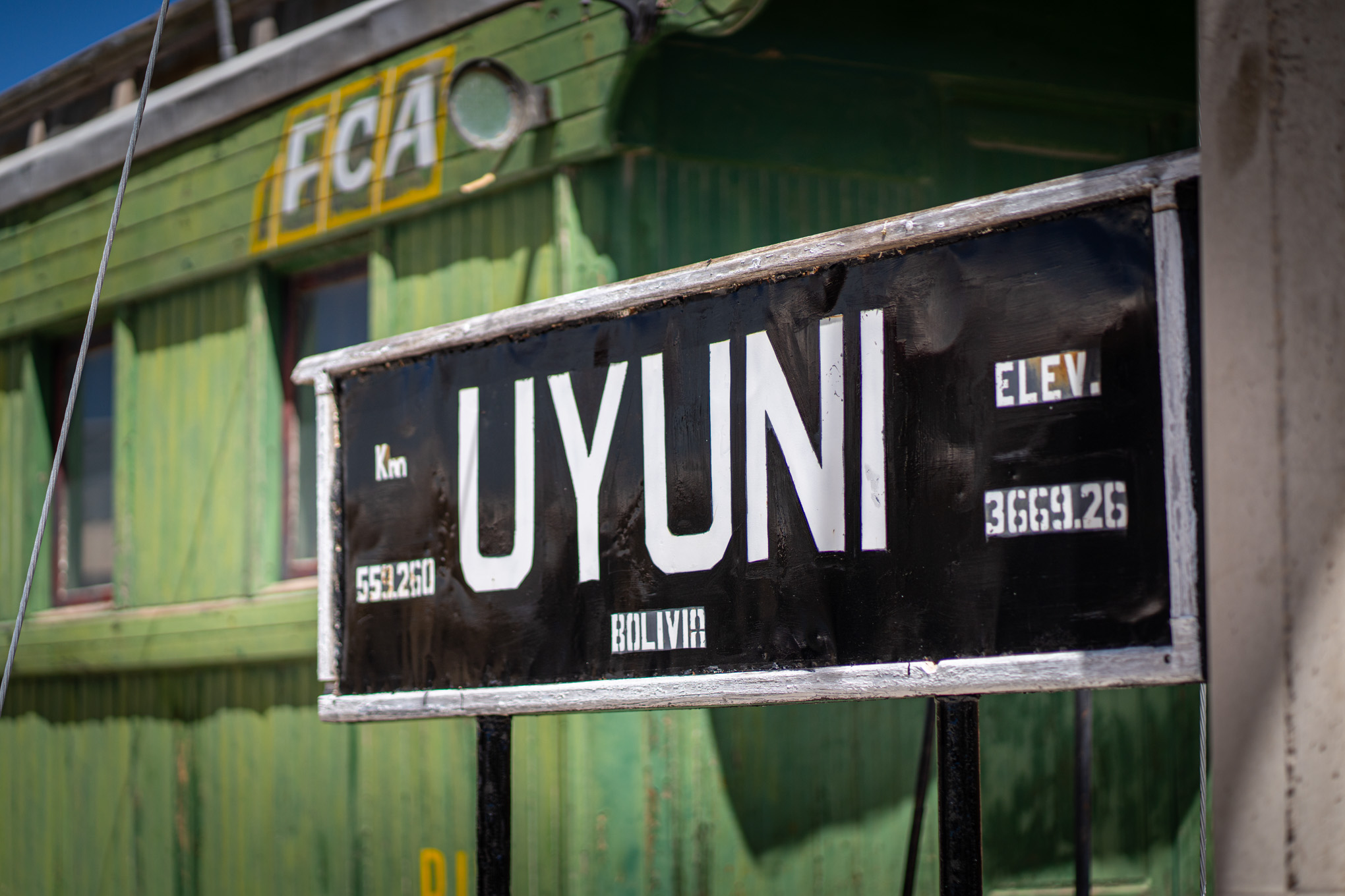
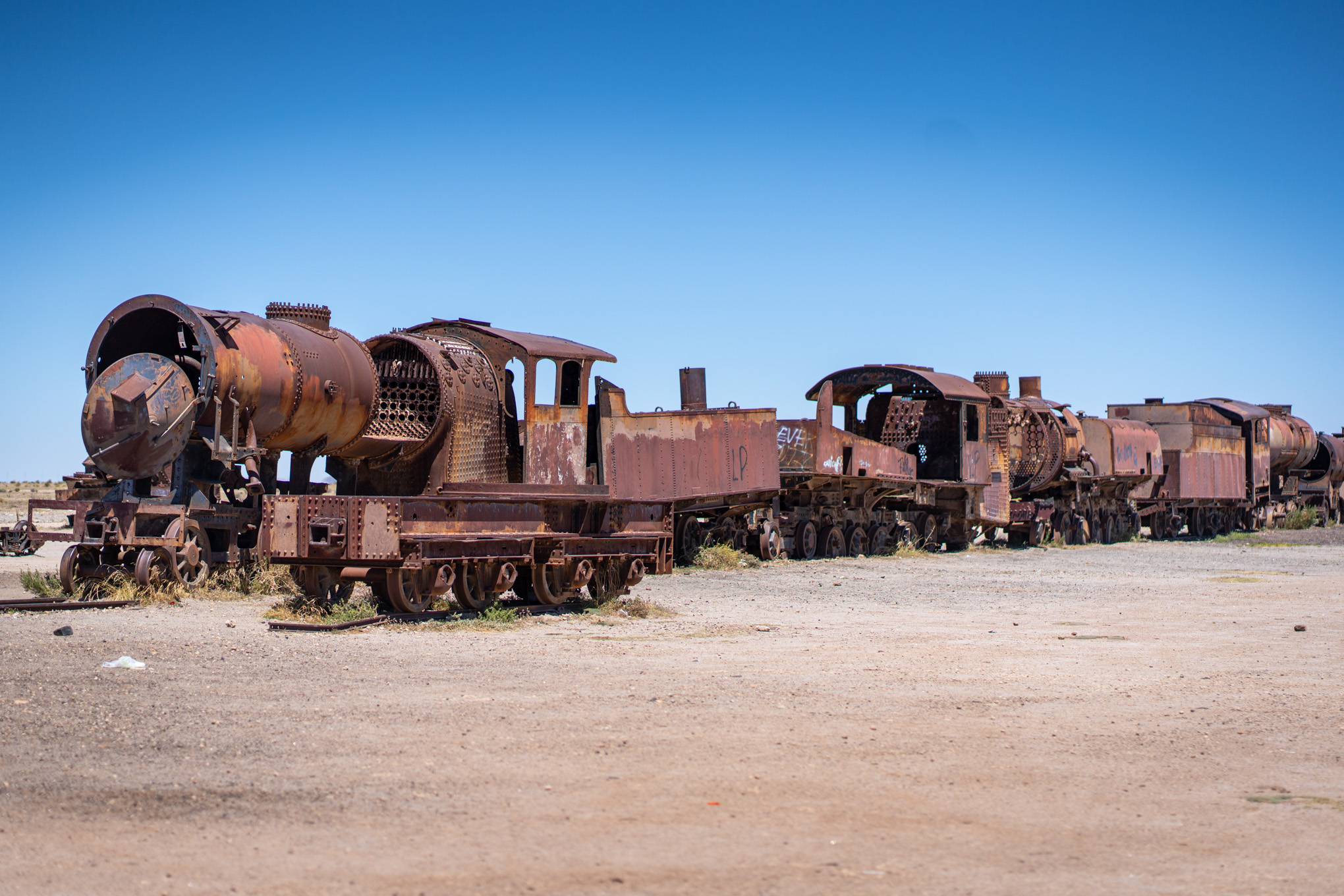
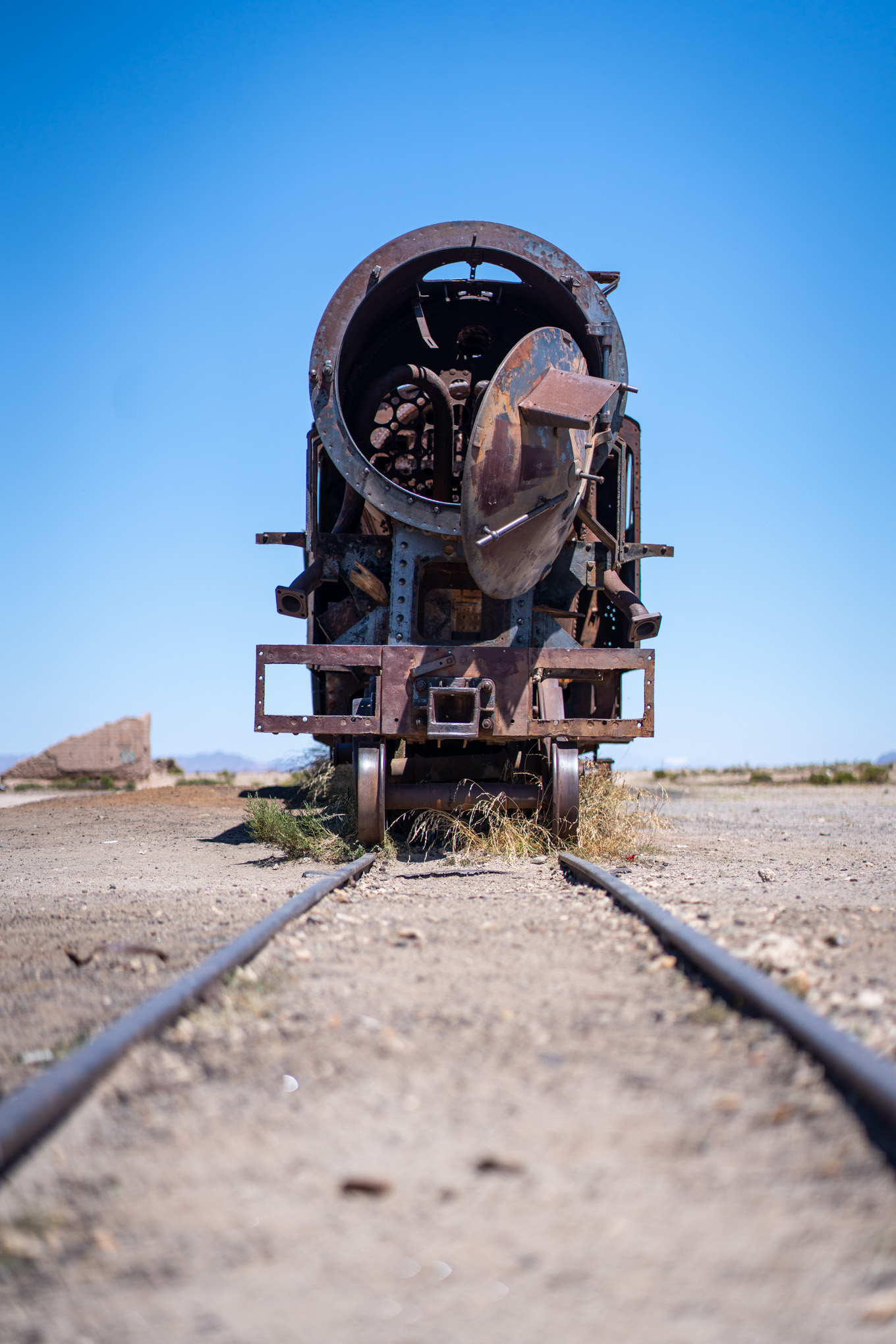
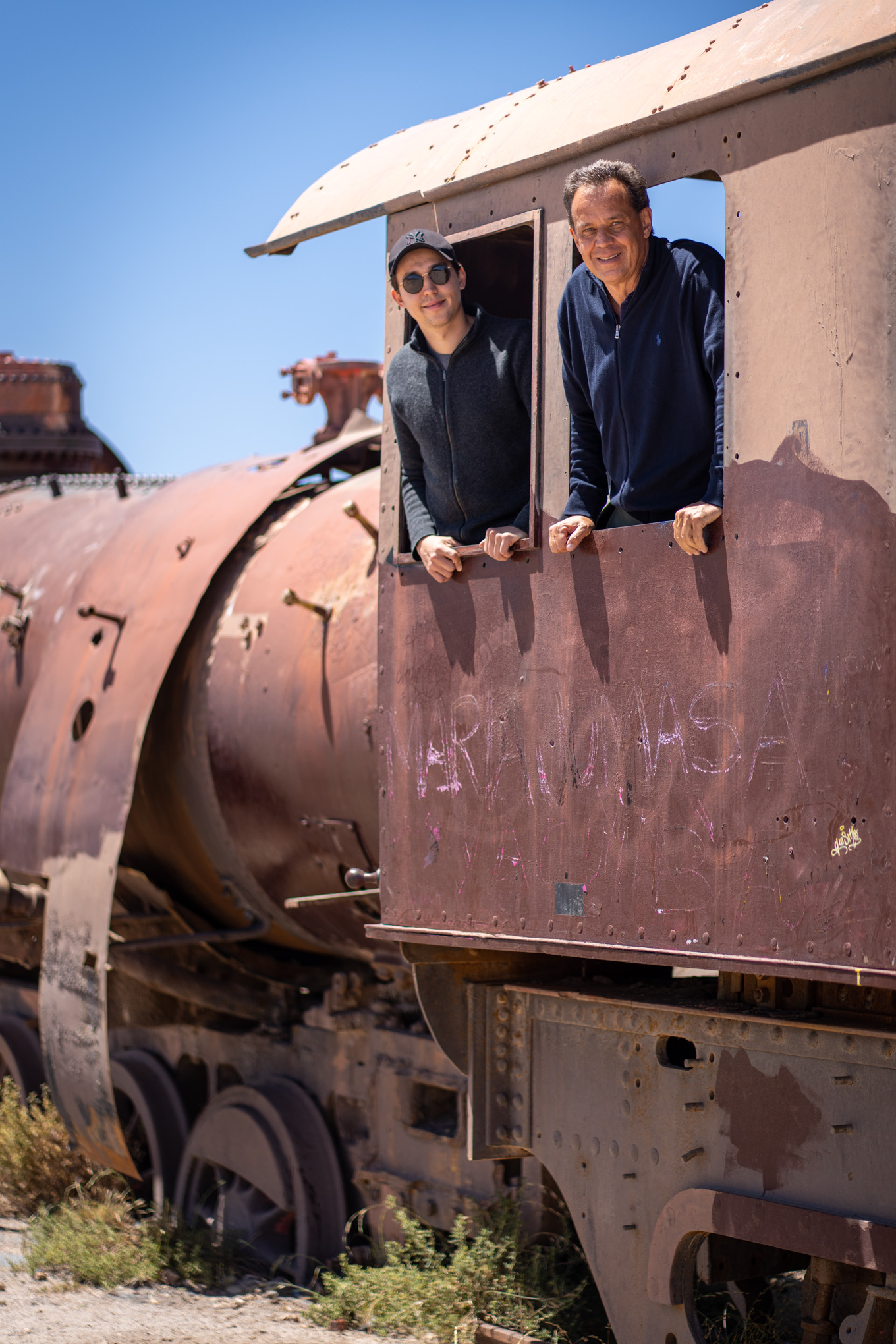
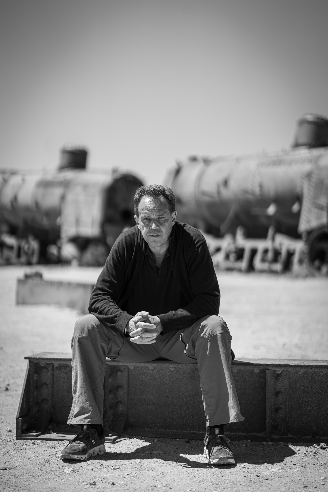
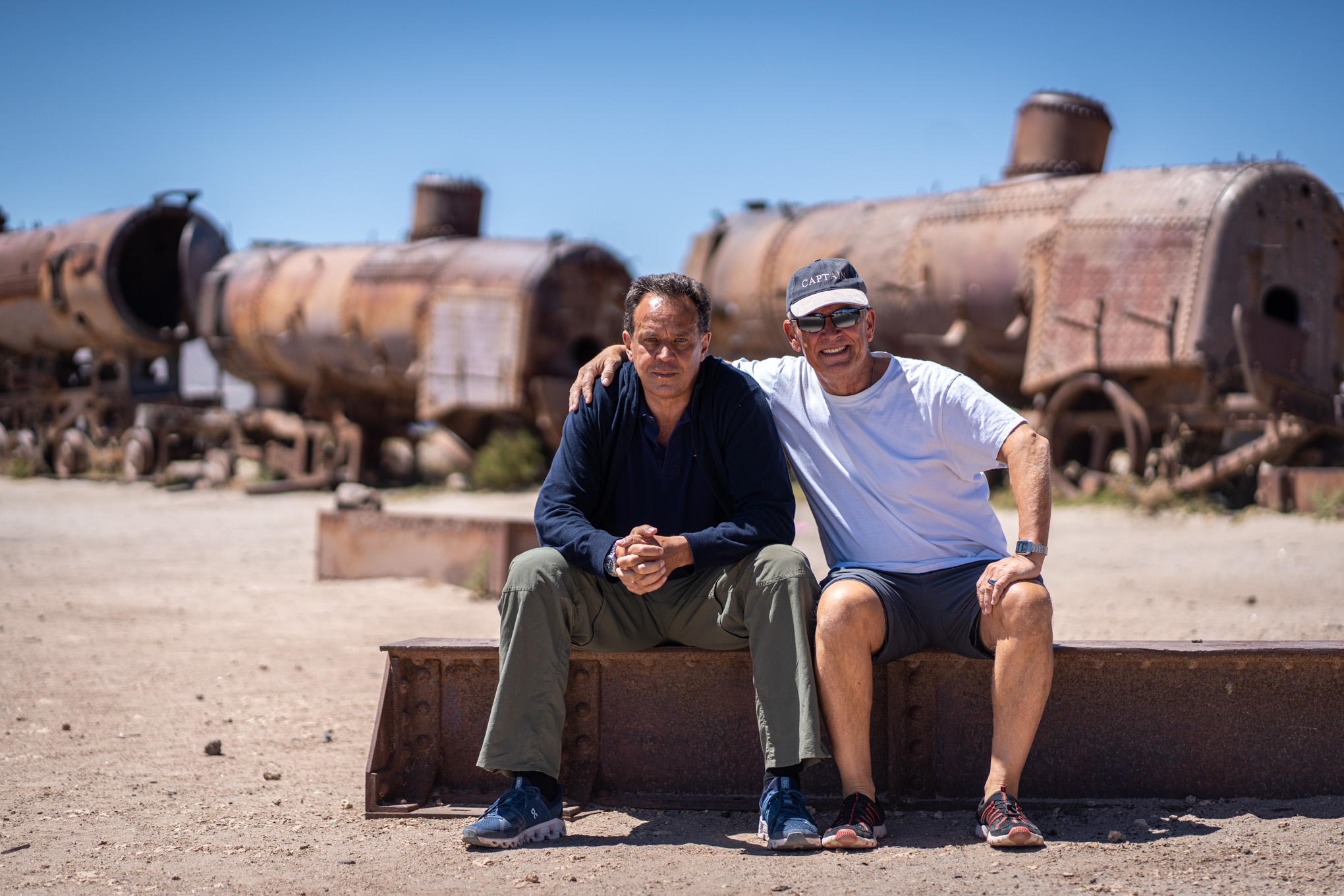
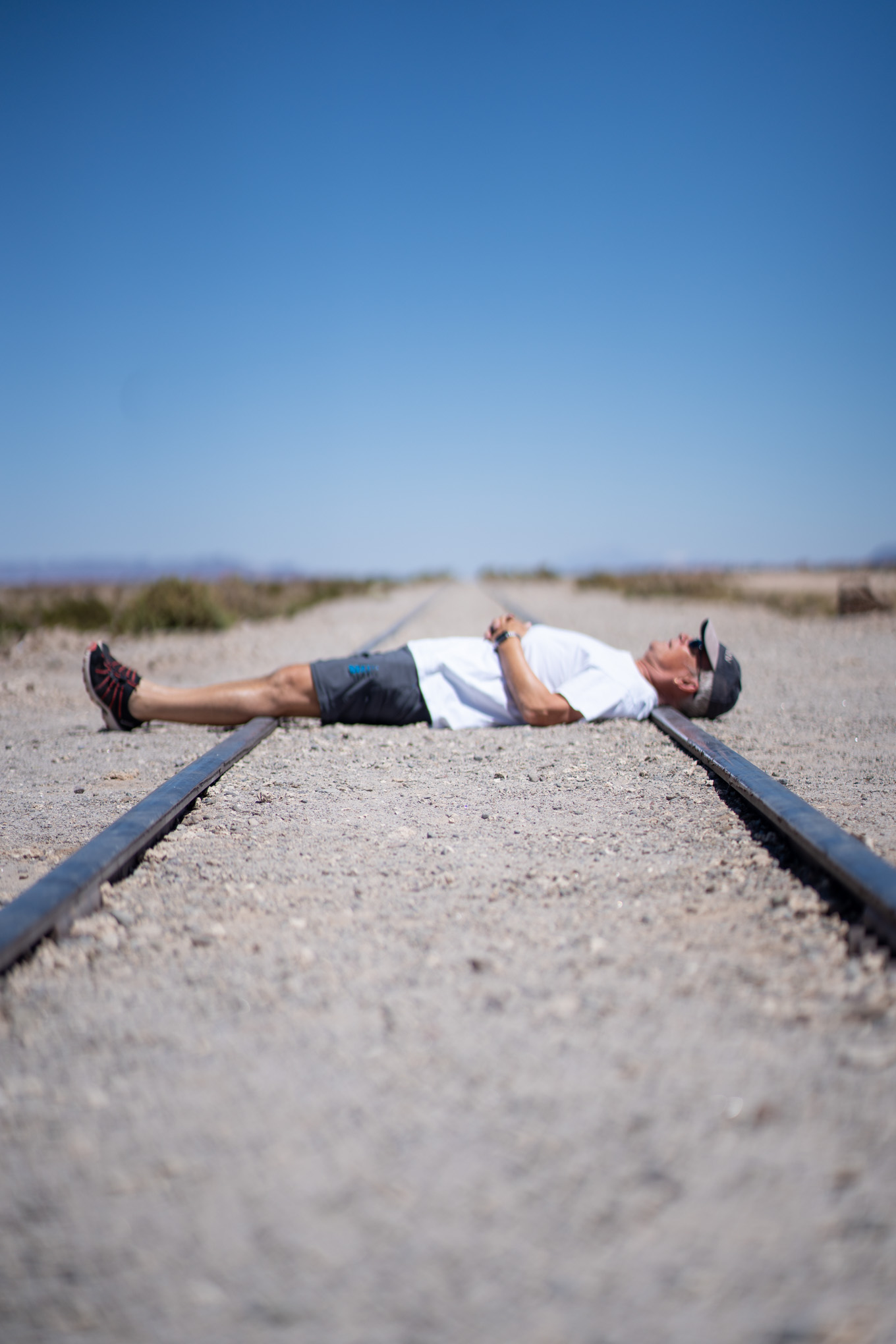
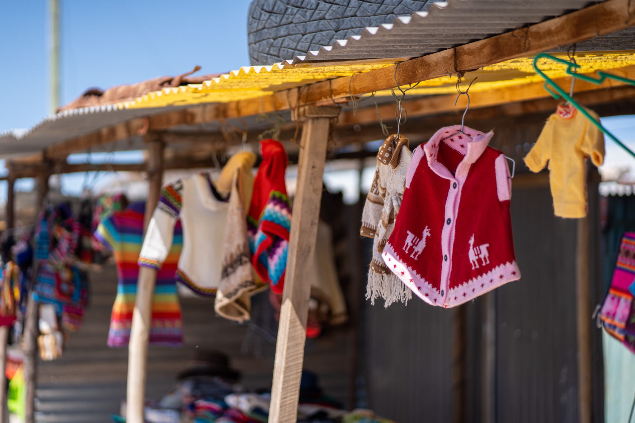
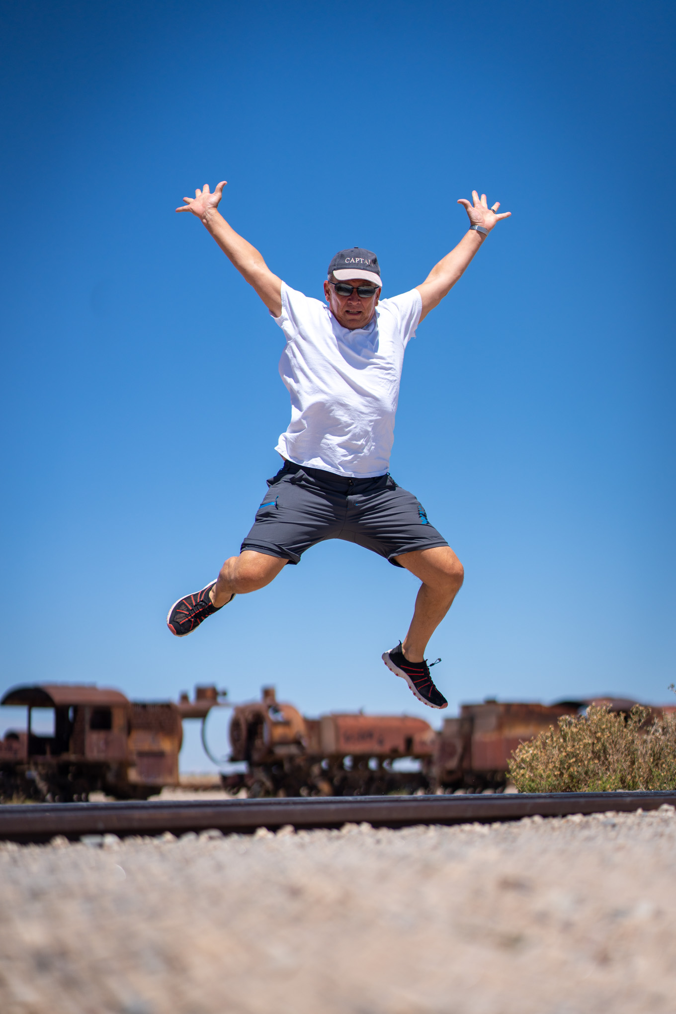
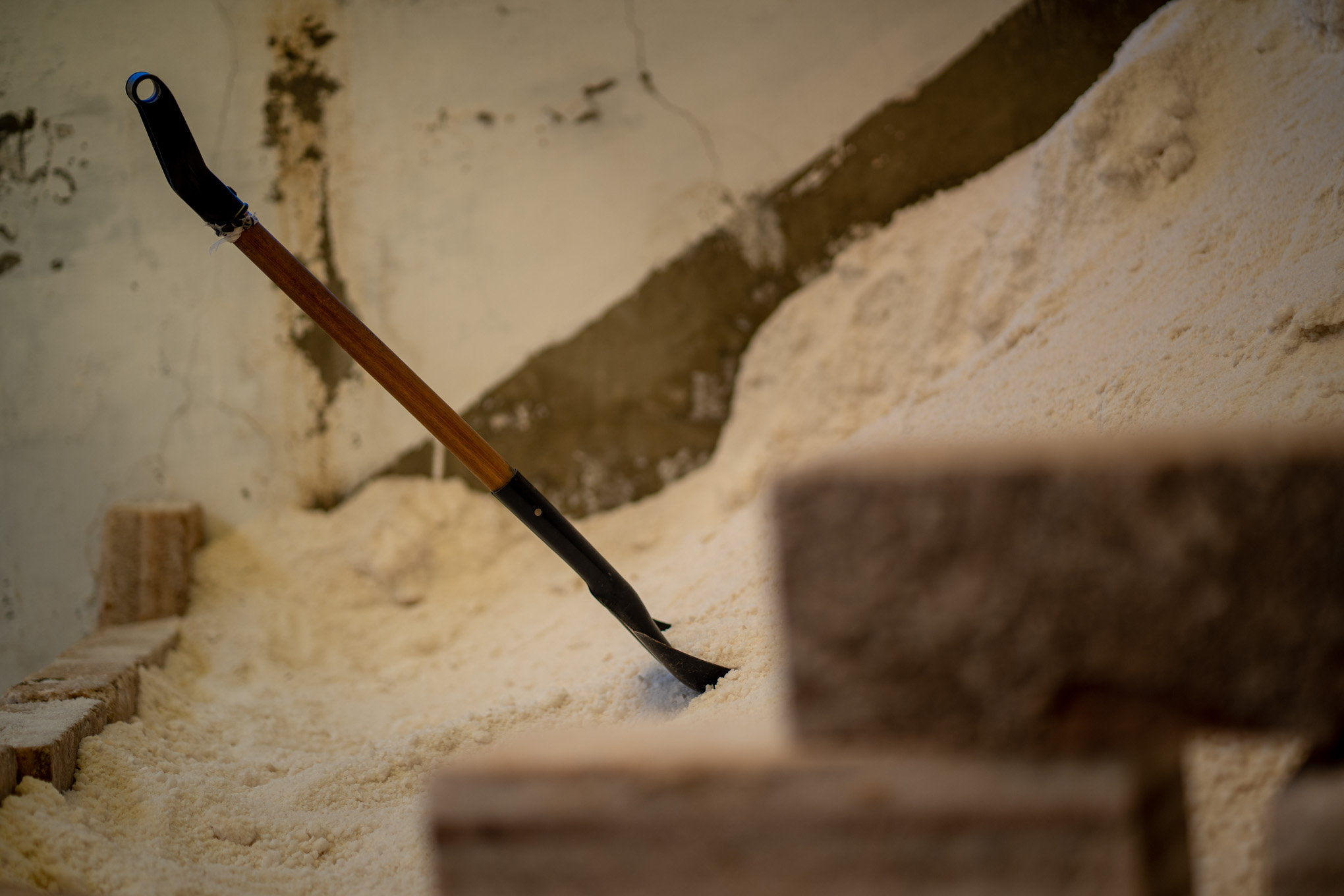
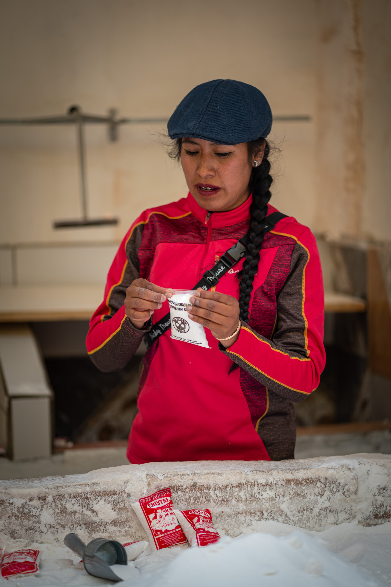
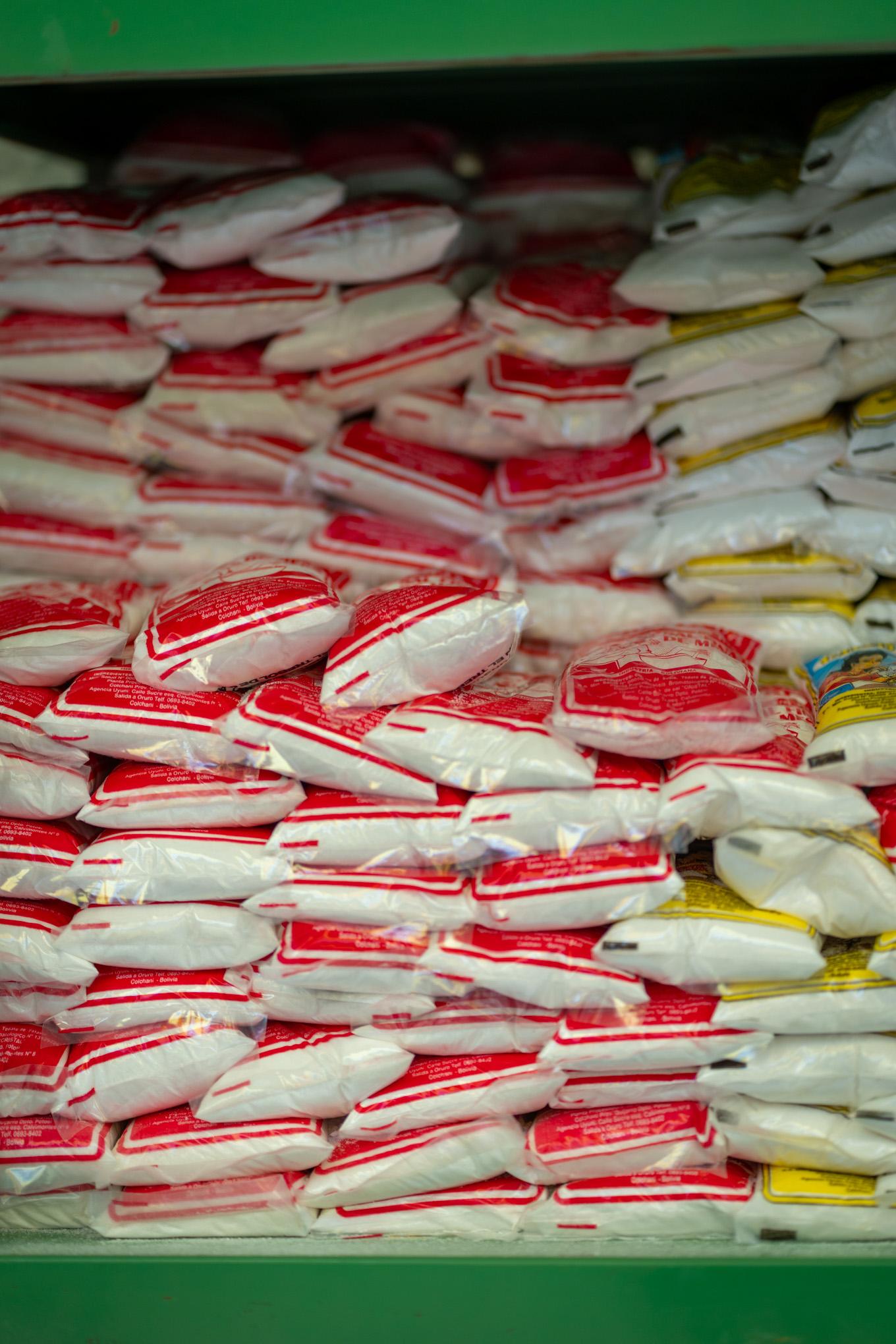
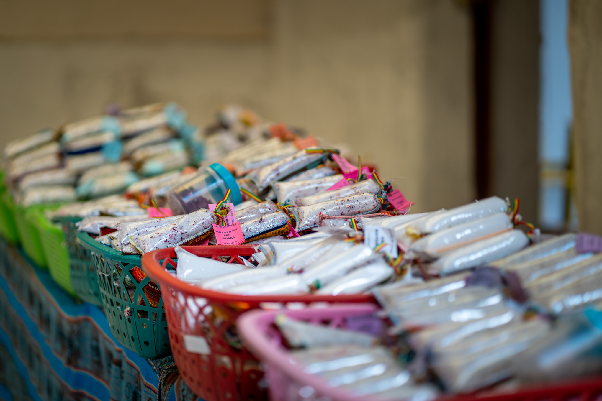
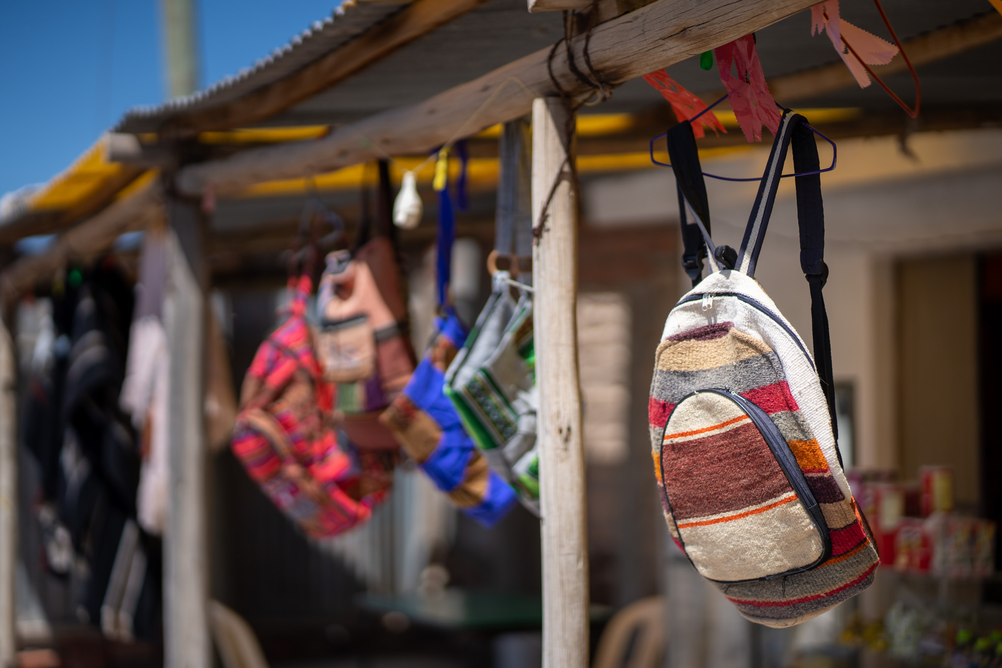
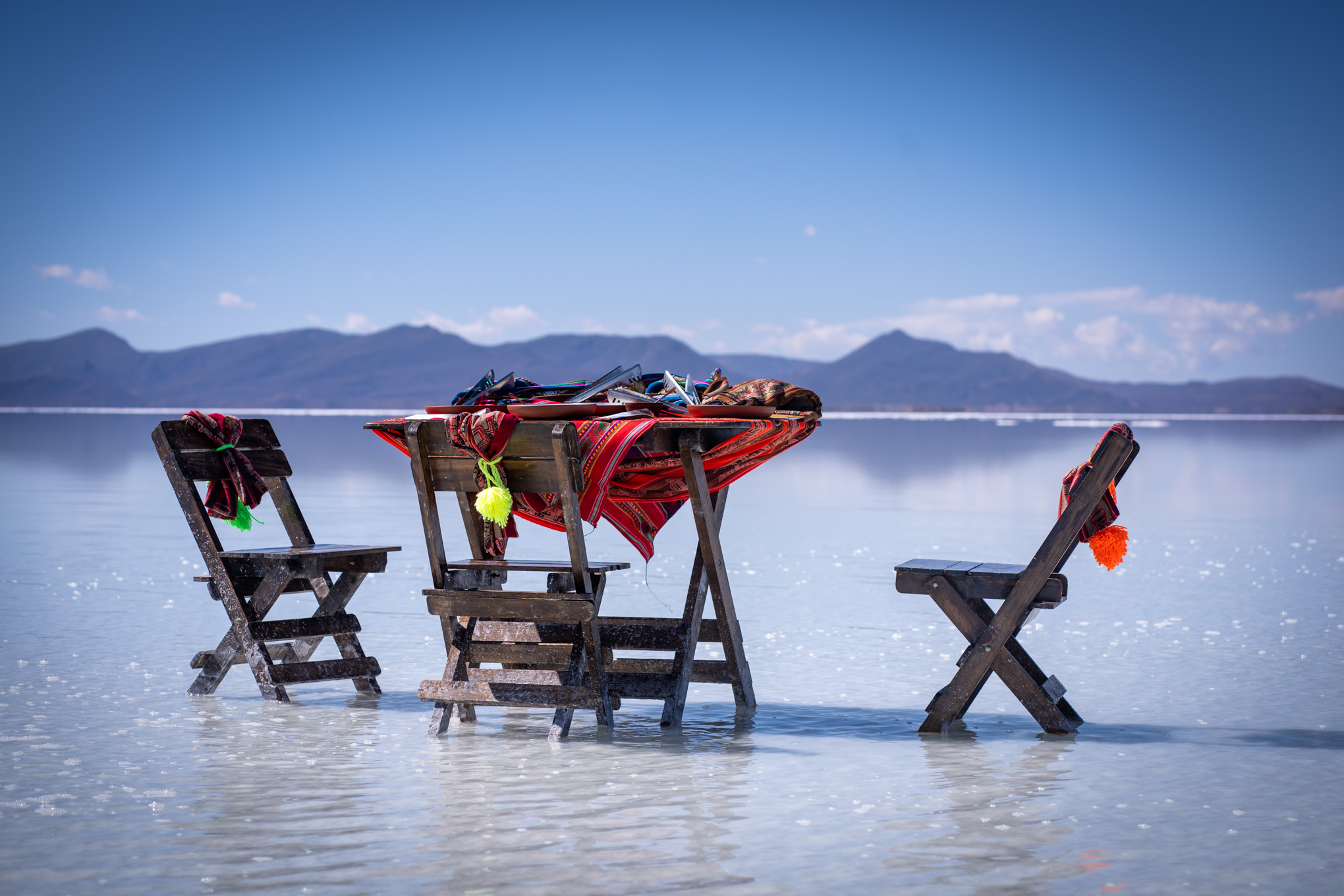
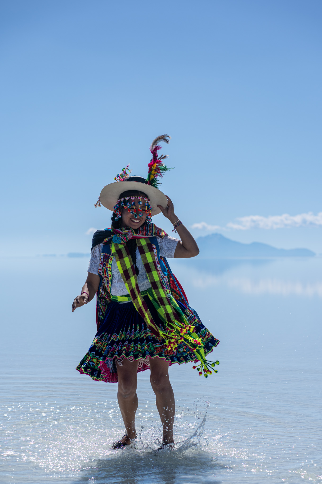
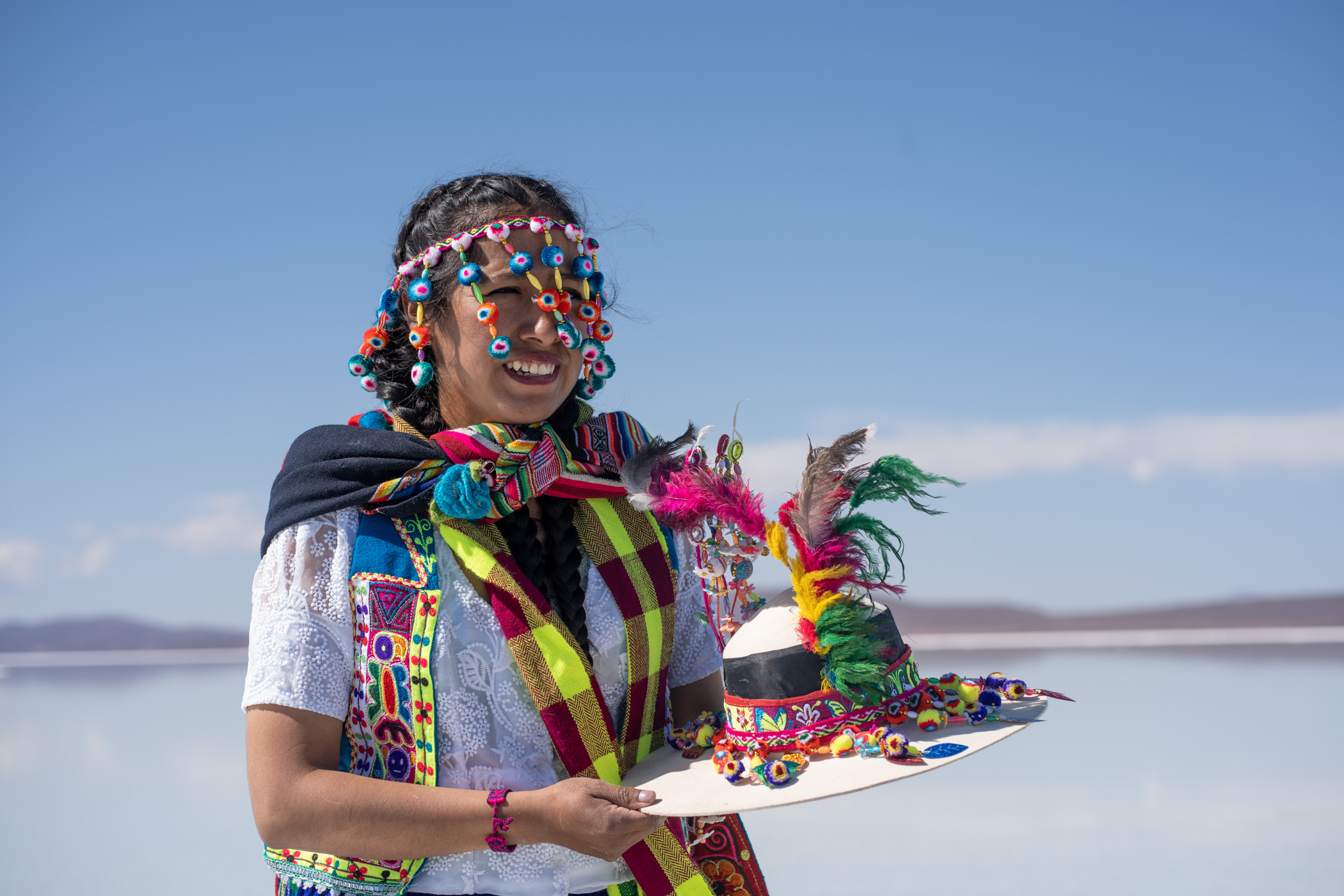
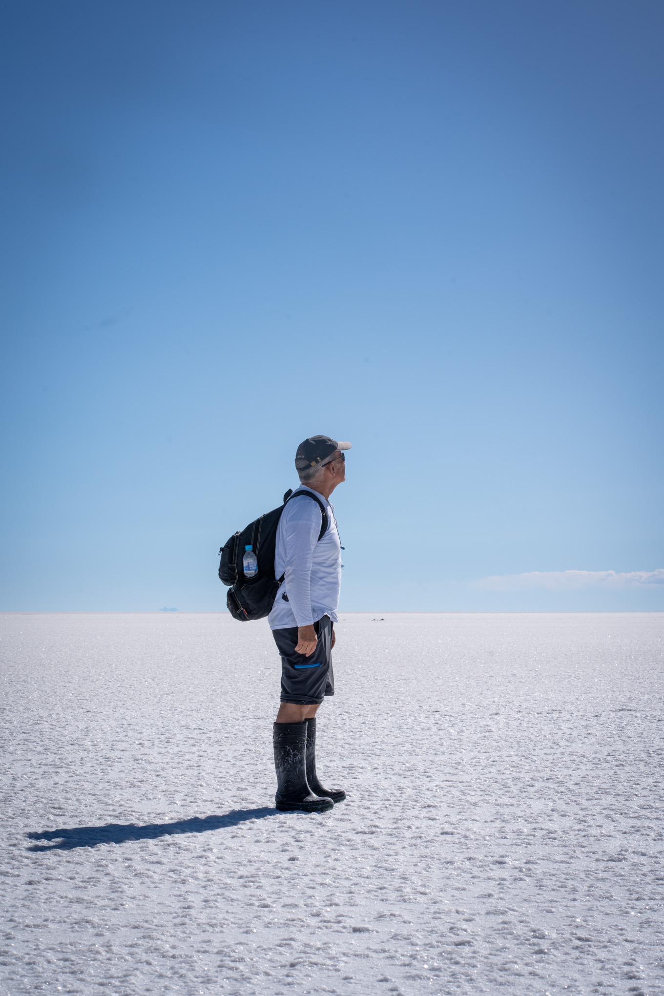
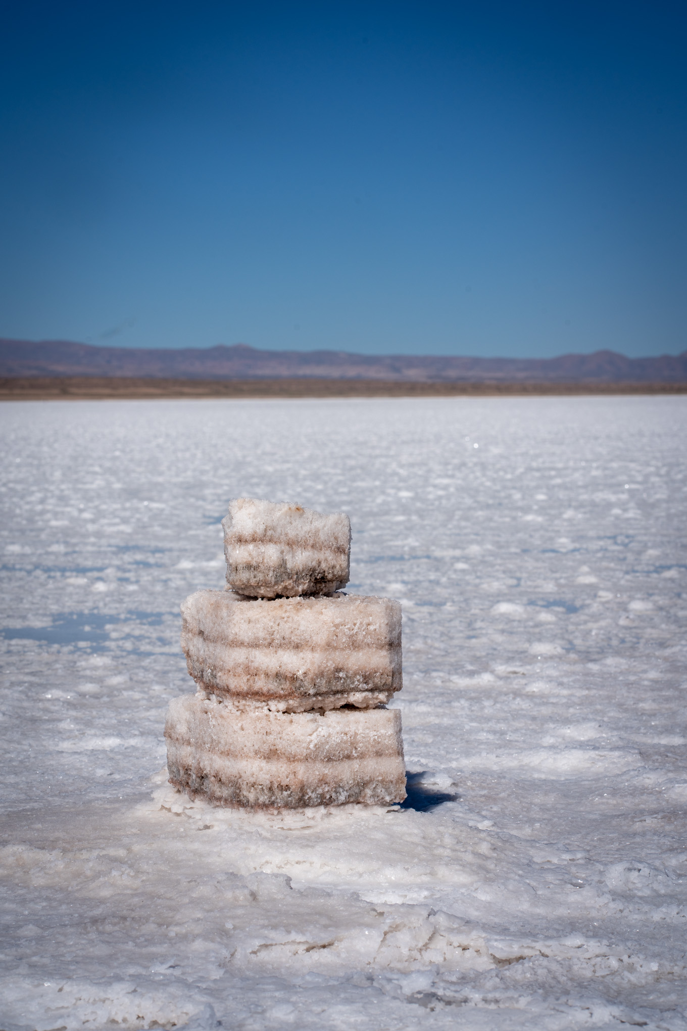
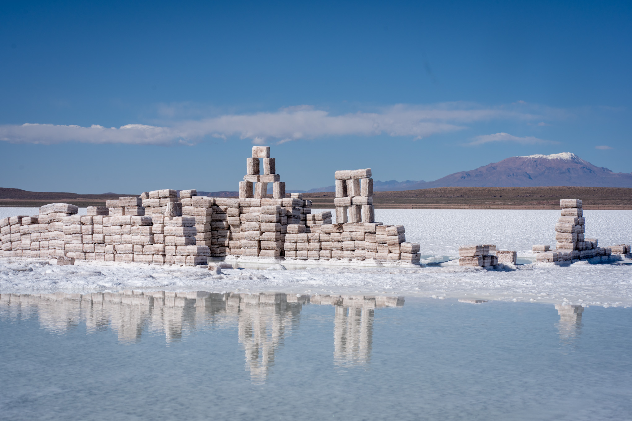
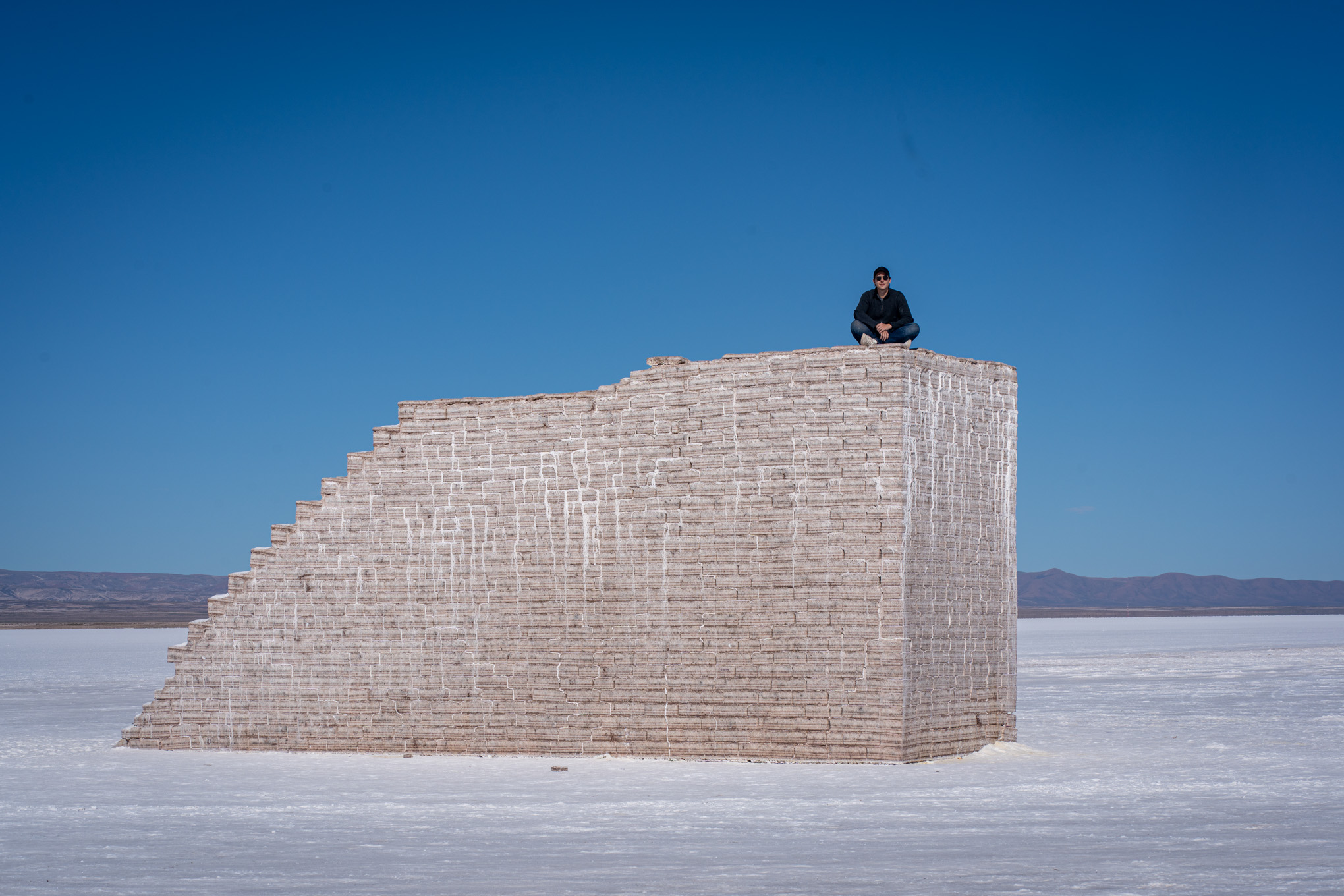
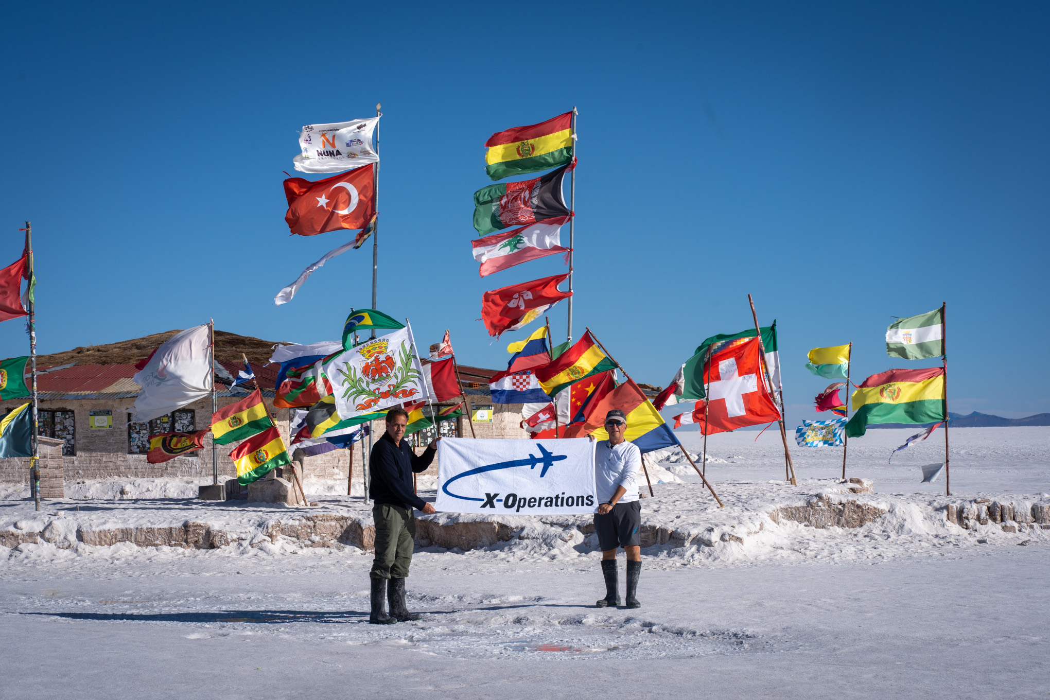
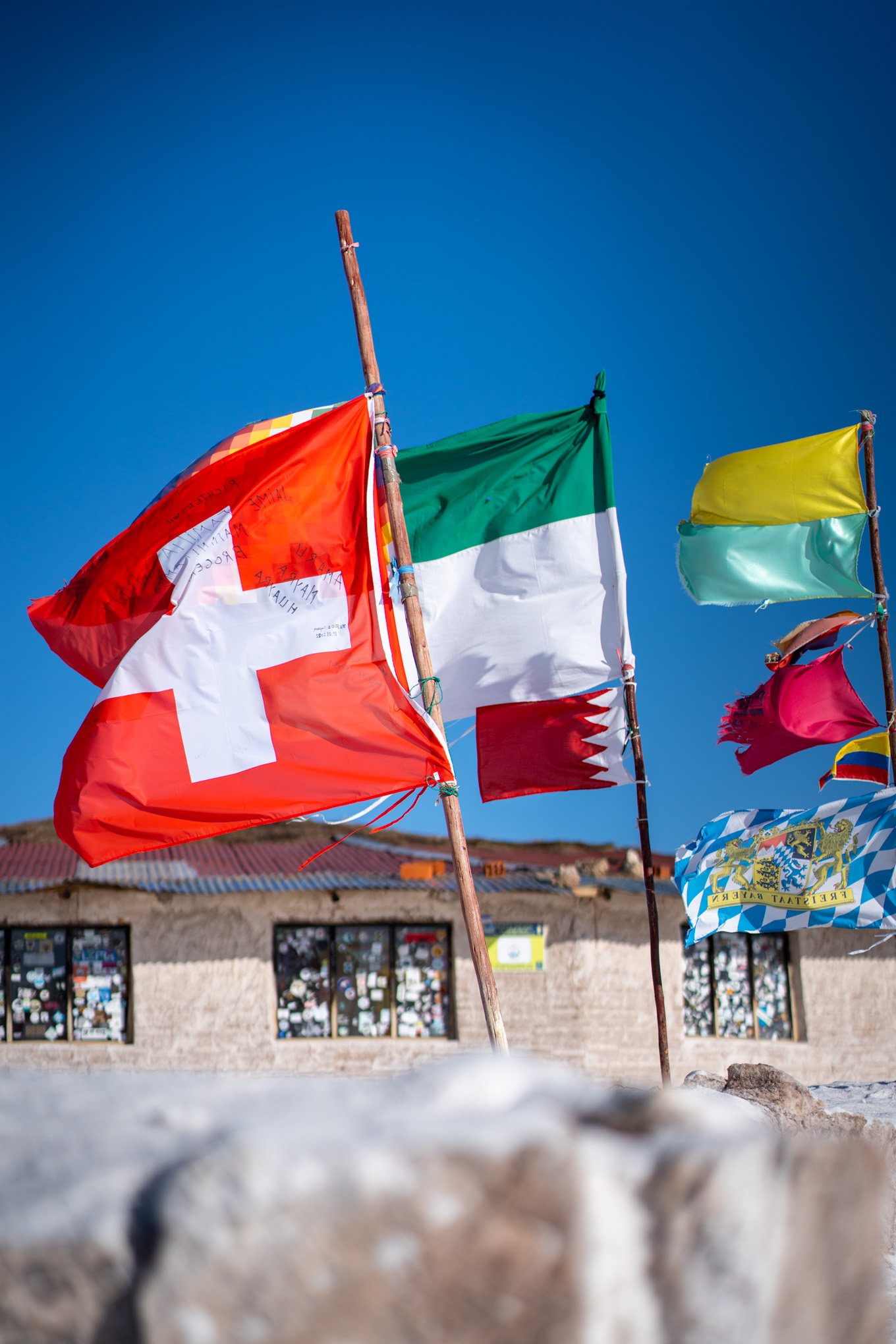
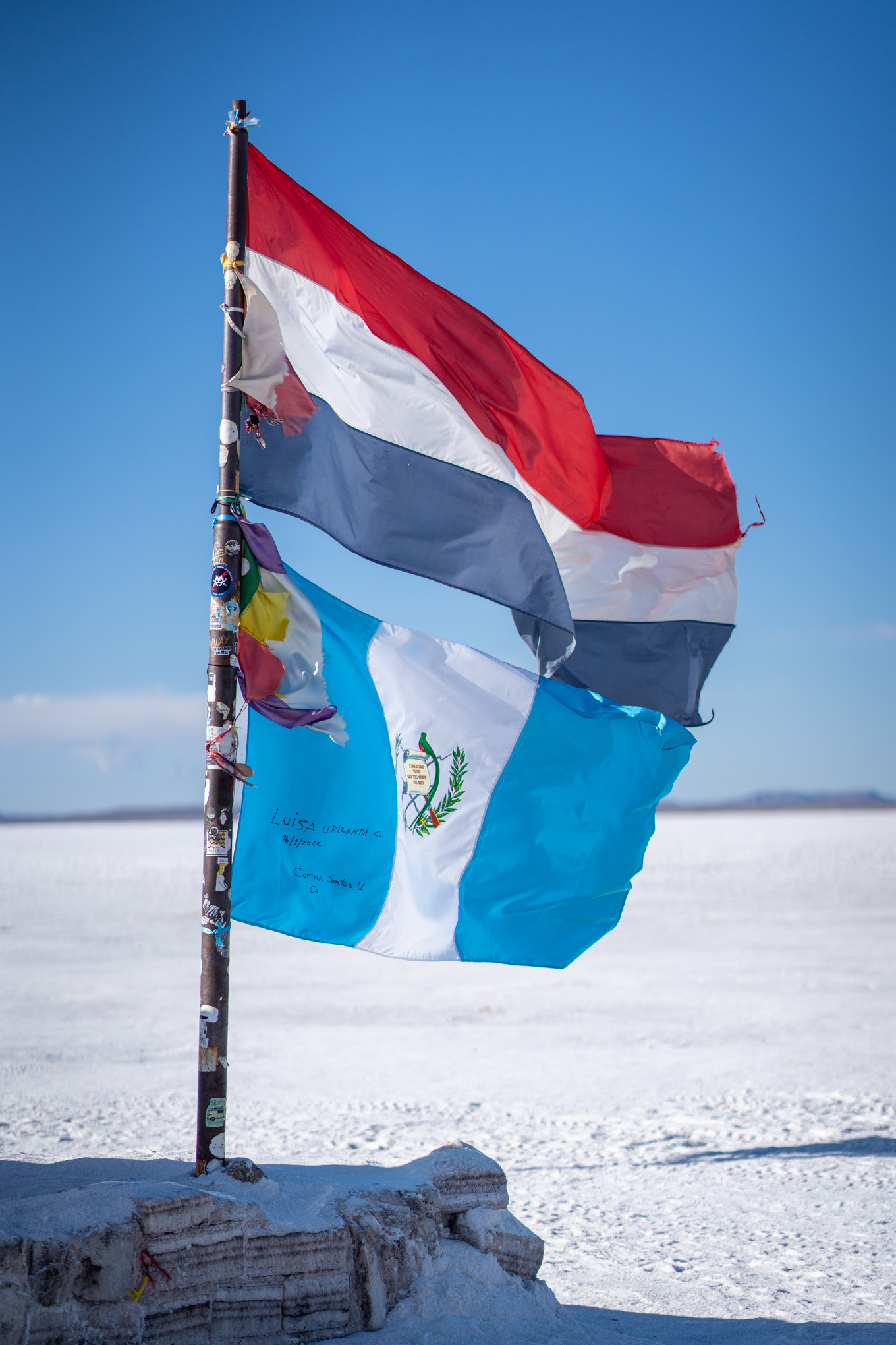
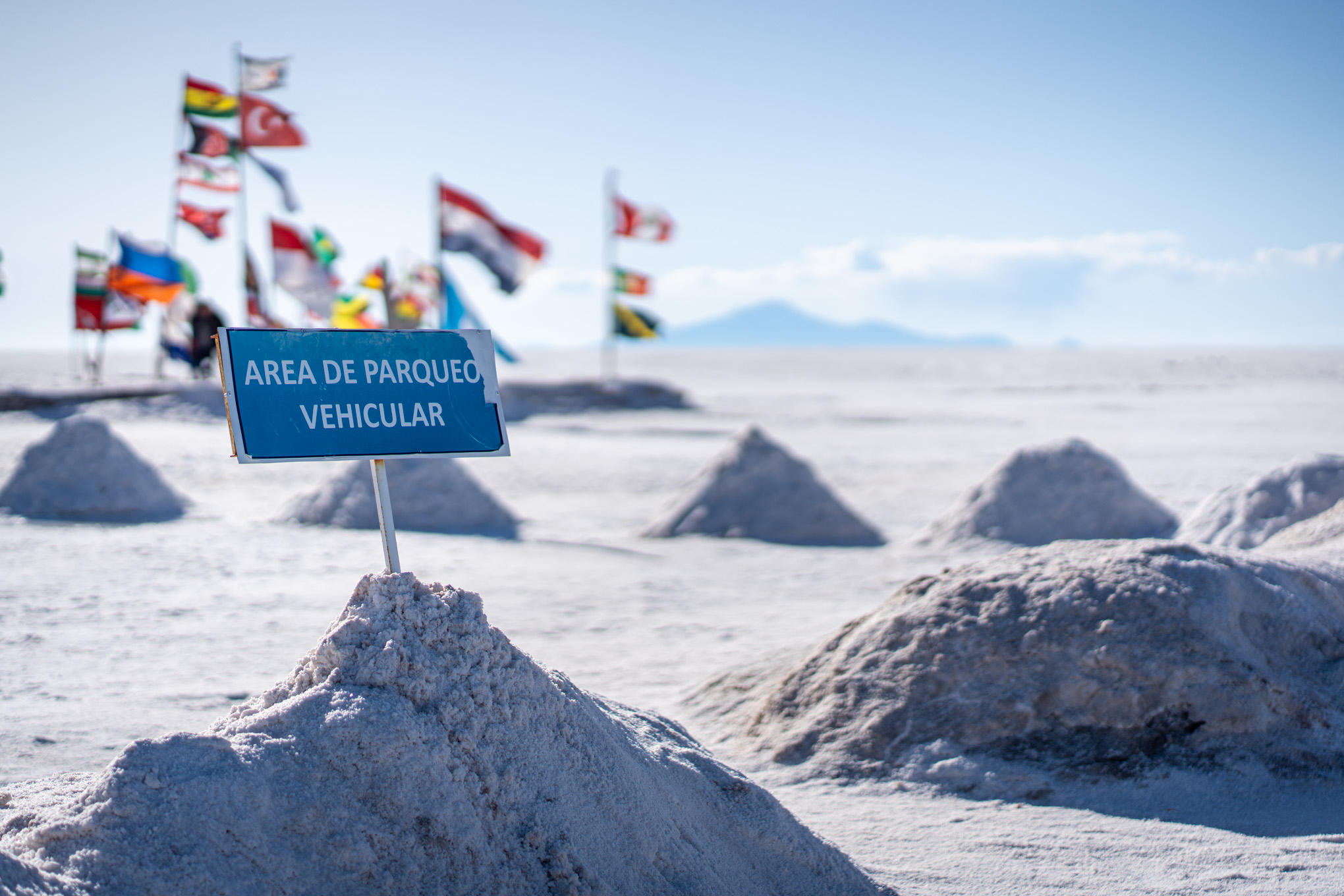
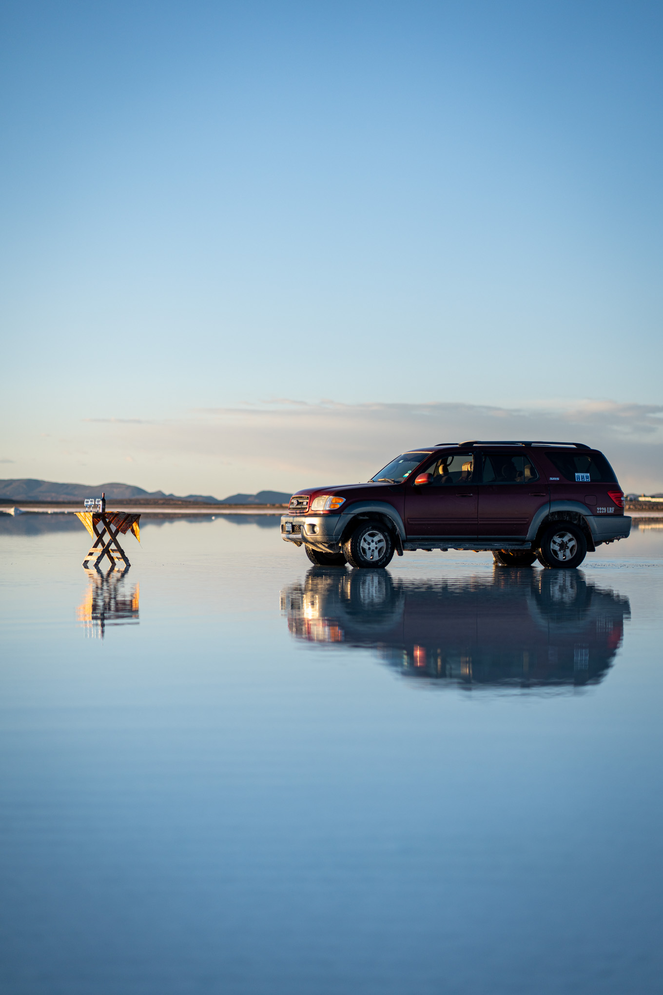
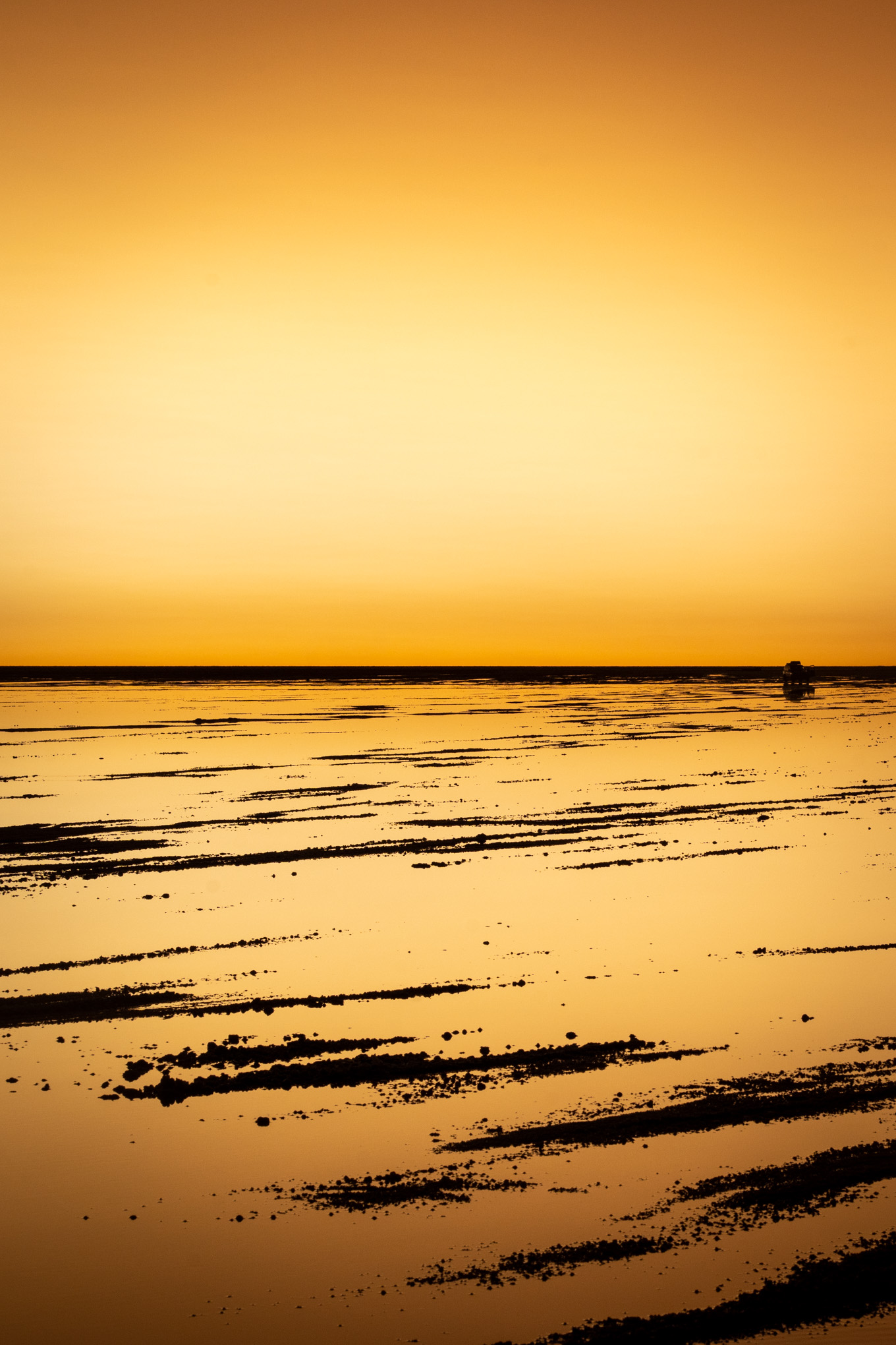
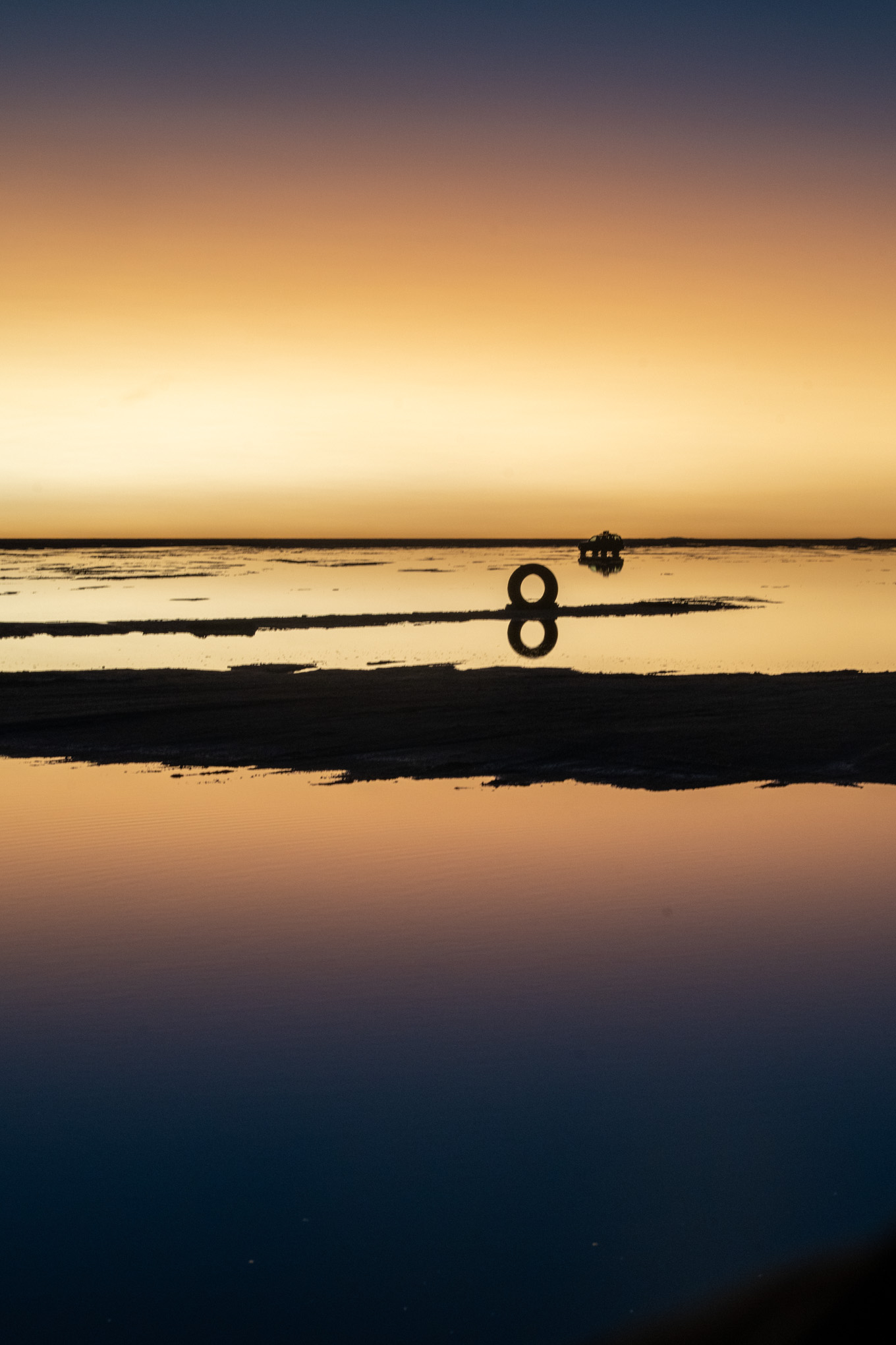
The second day started off with a travel classic; a PCR Corona test. After barely fining the clinic, and a subsequent very thorough corona test, we continued onwards to the train graveyard in Uyuni. A remanent from the companies that used to mine salt in the area, the train graveyard consisted of about 50 or so steam engines that were left there to rot. It is one of the main tourist attractions in the area; this was felt as we were far from the only group there. It was pretty cool to see, and we had fun taking pictures and roaming through the scrap metal. The next stop of our day tour was a salt manufacturing house. Our guide gave us a run through of the salt extraction process, and quickly ushered us into the tourist shops. More of an excuse to lure tourists to purchase souvenirs, we made some small purchases and continued onto the salt plains. After about a 45min drive, we stopped for lunch. The spot our guide chose was in the middle of the great salt lakes, and slightly covered in water. This made for some cool reflections in the water, and a stunning landscape. We had some pulled lama, amongst other things, and enjoyed the views and surroundings. Subsequently, our guide showed us around the dry parts of the salt planes. We learned about how salt bricks were extracted, took some funny perspective pictures, and then also visited a flag planting station.
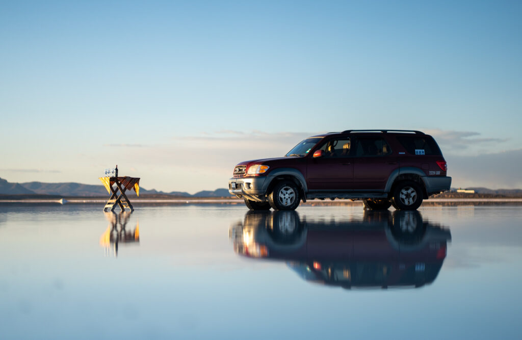
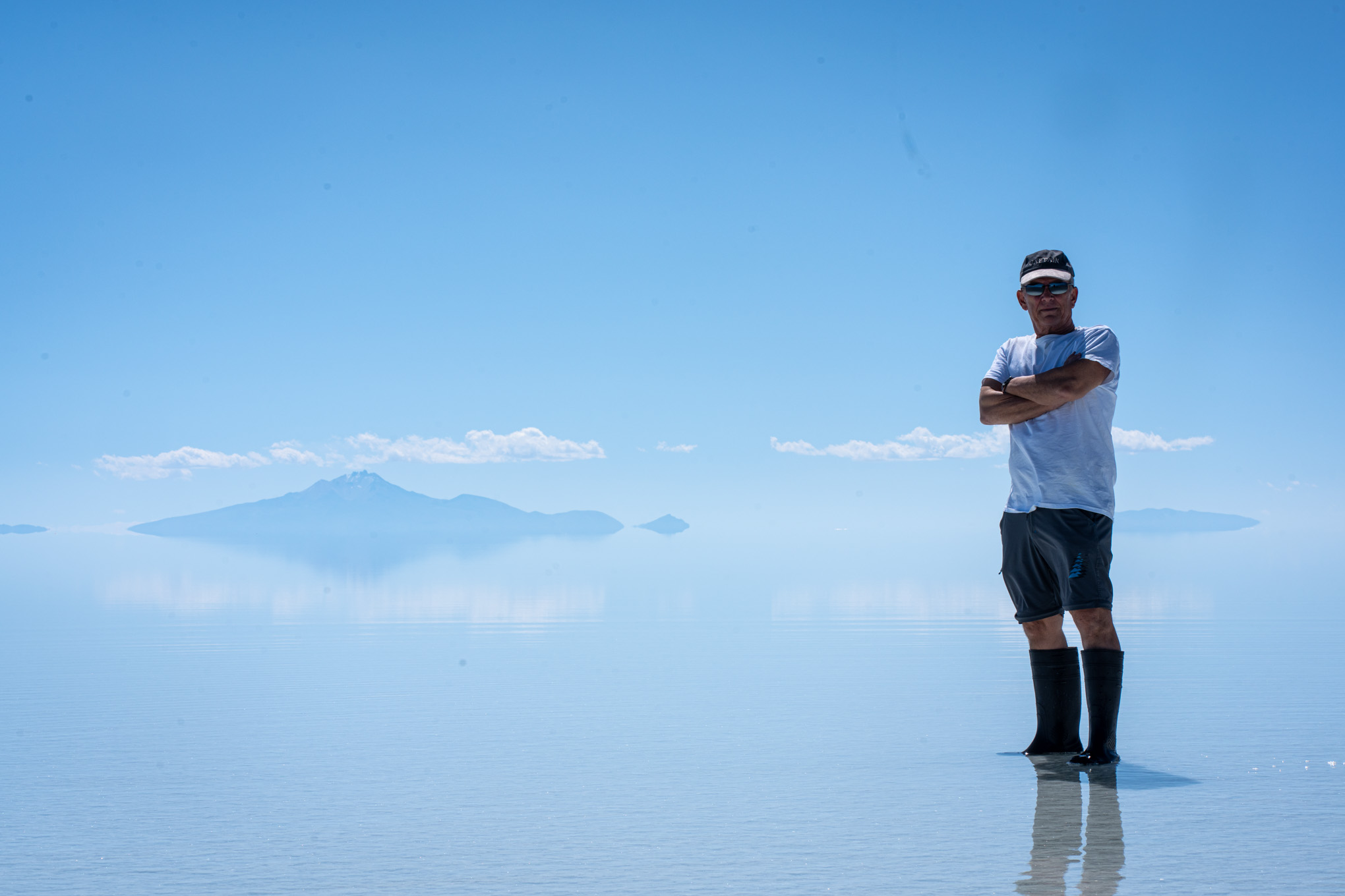
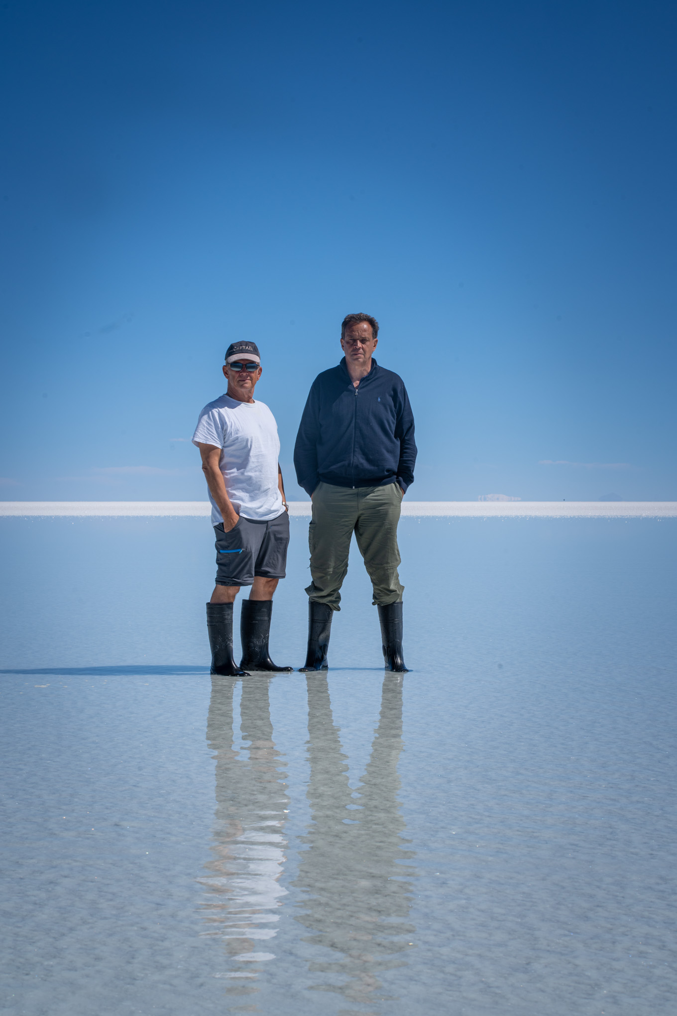
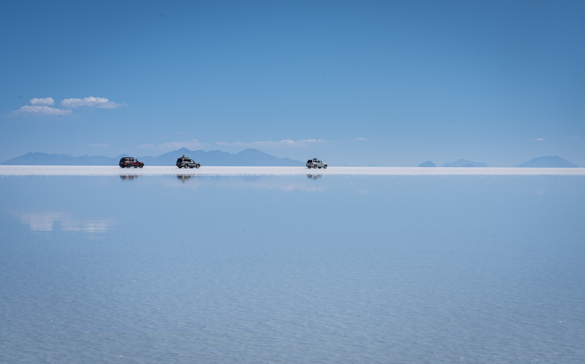
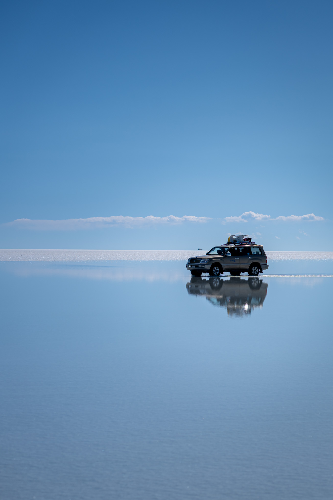
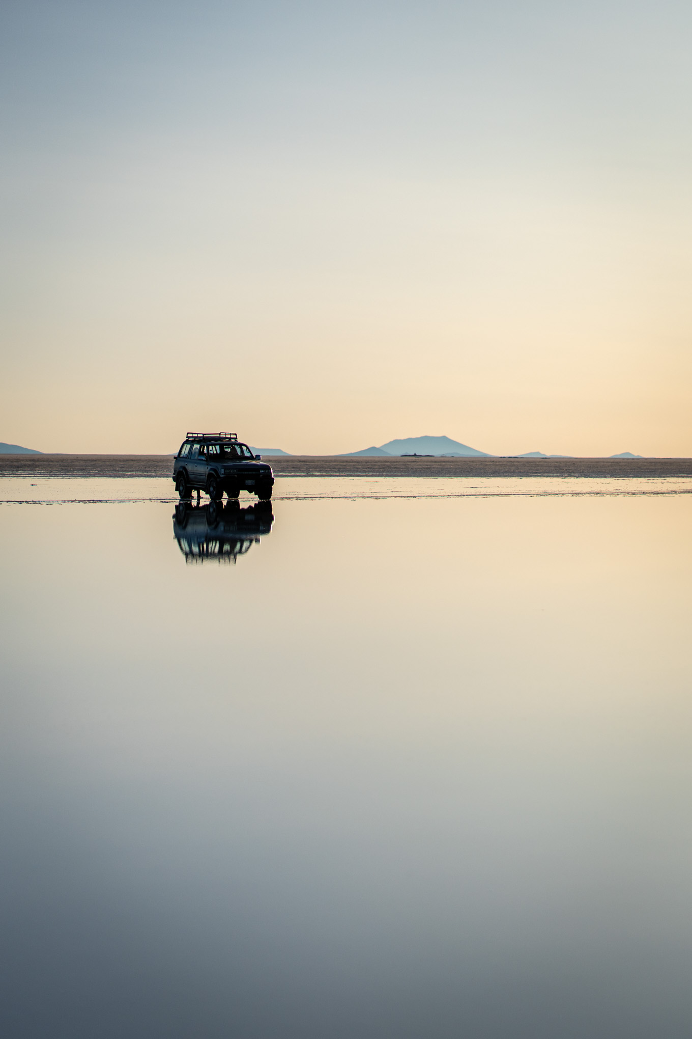
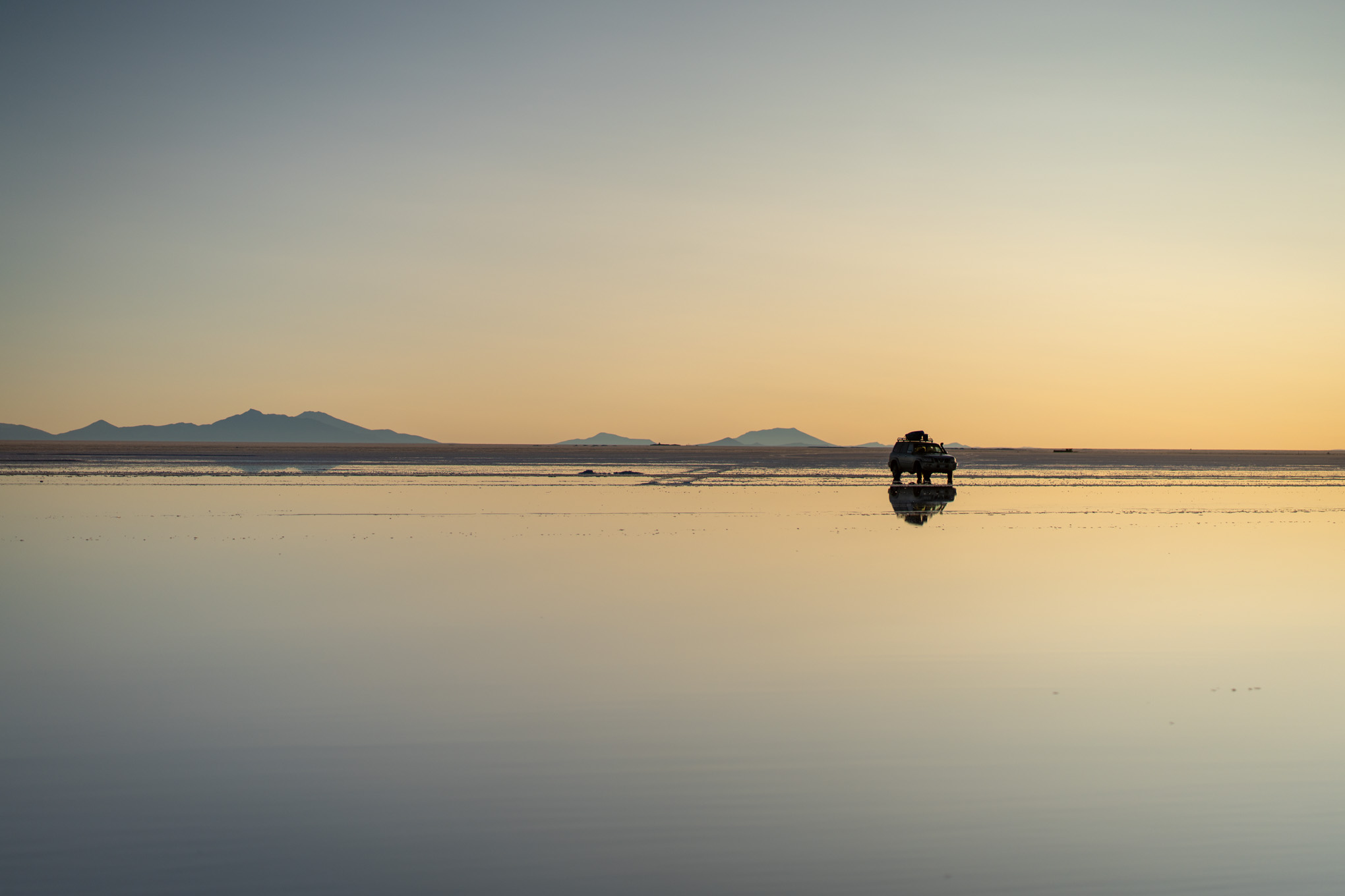
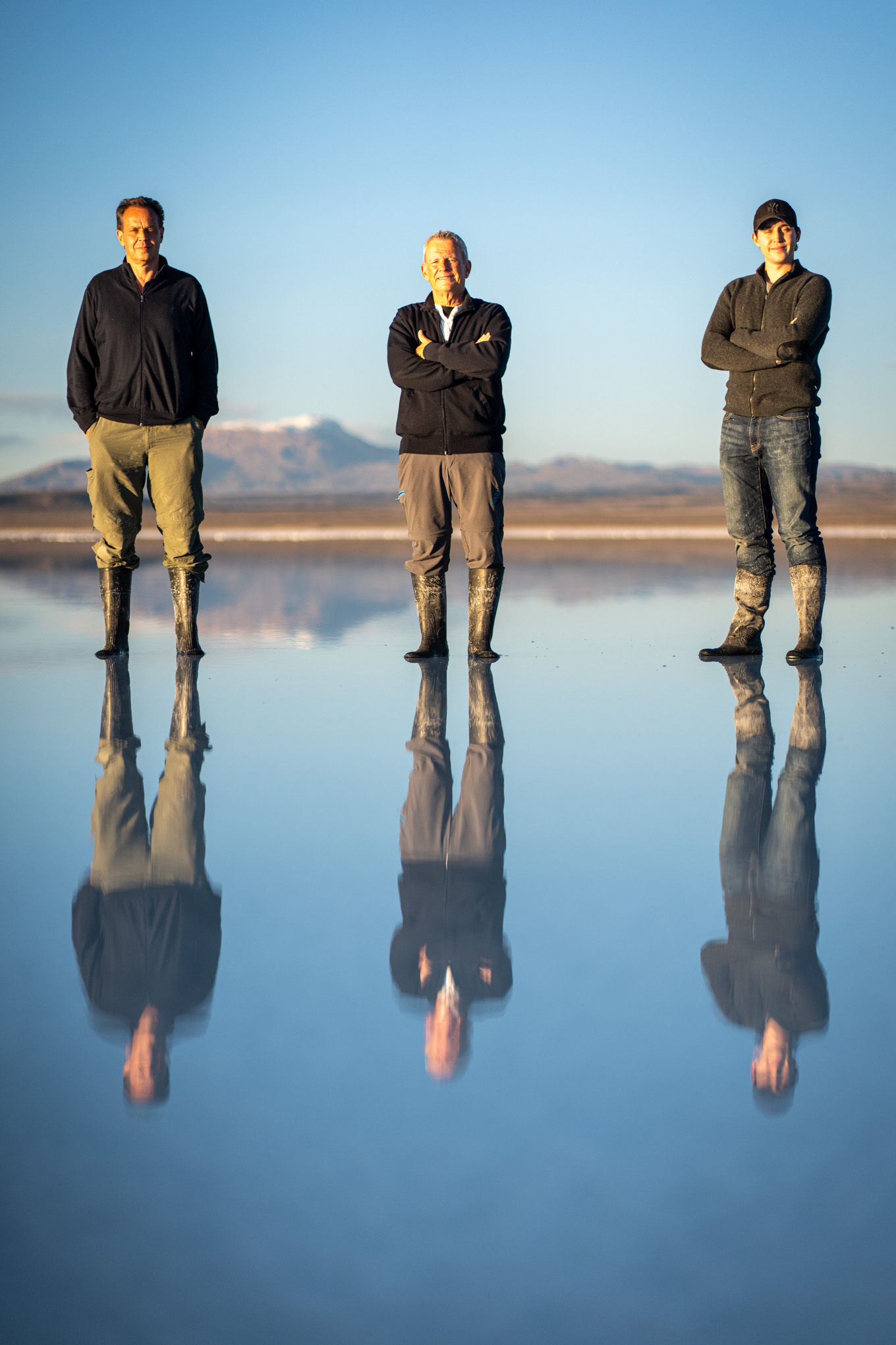
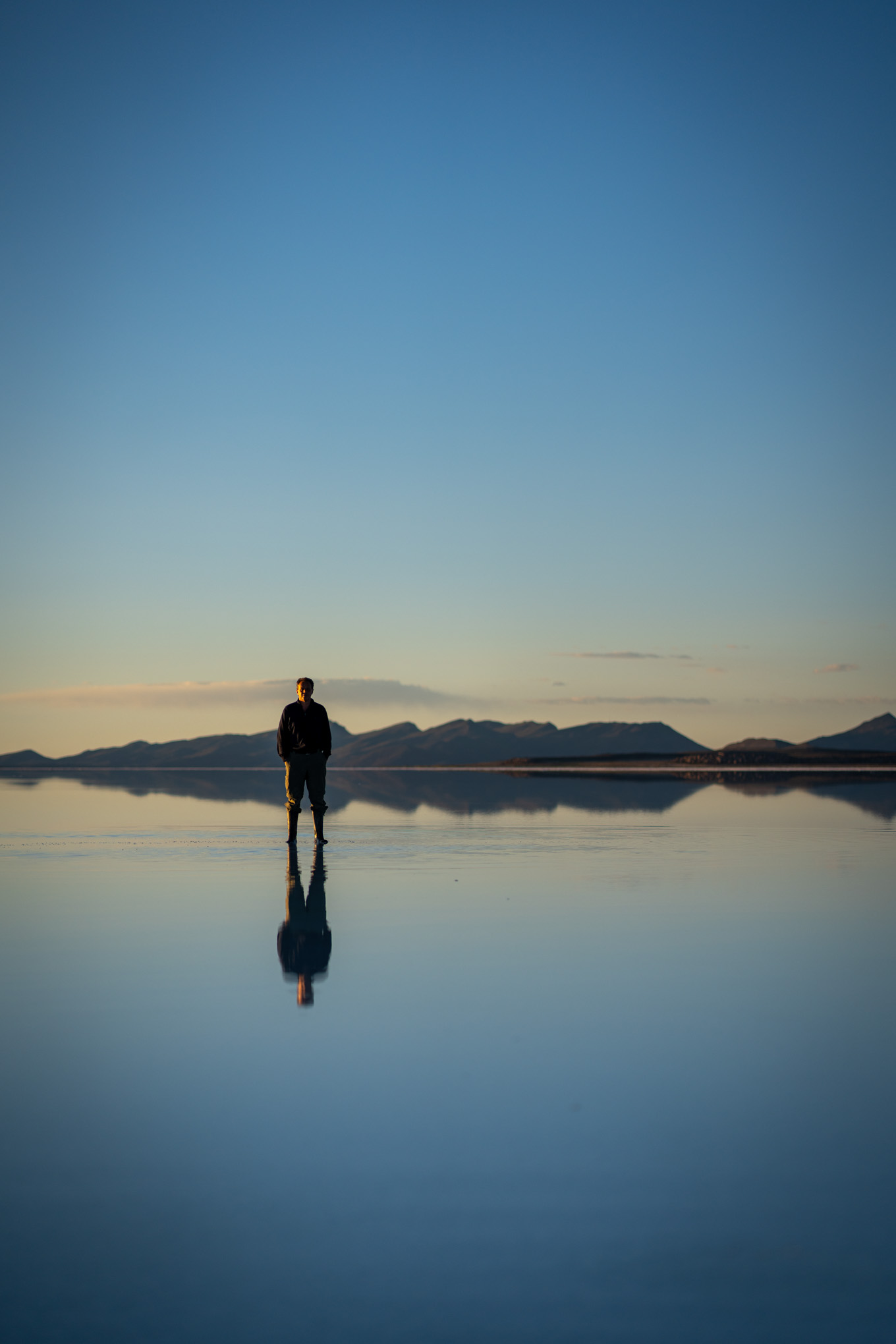
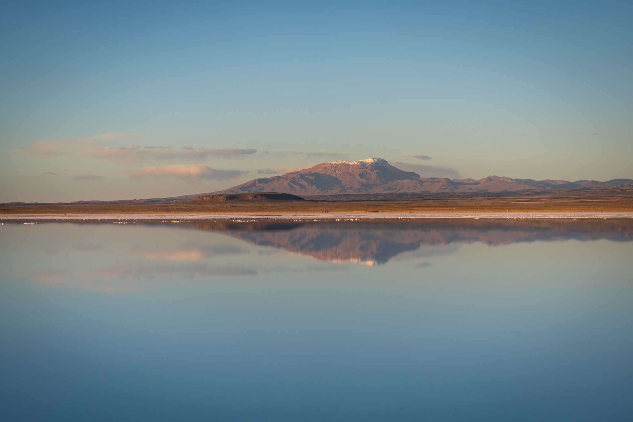
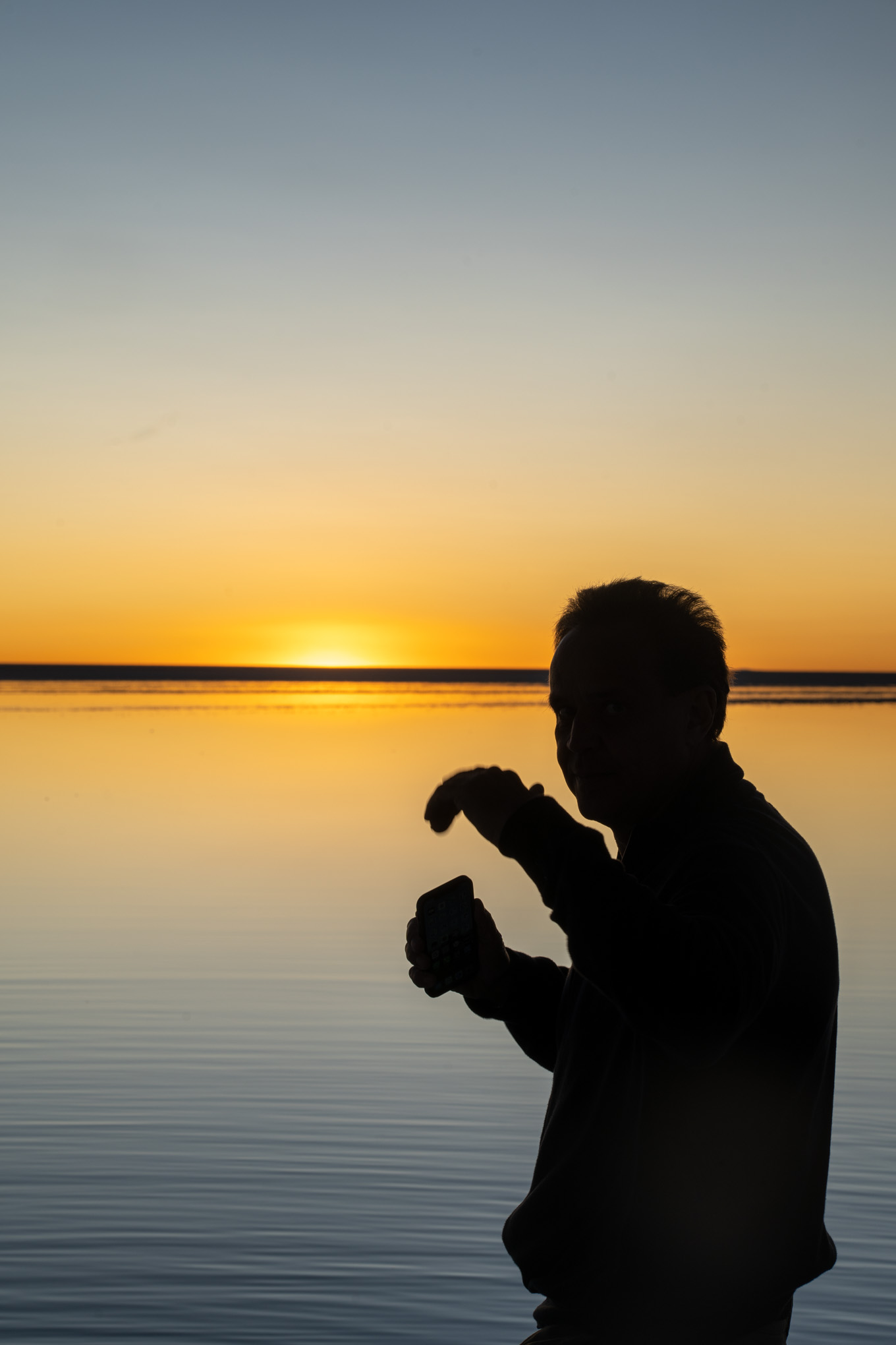
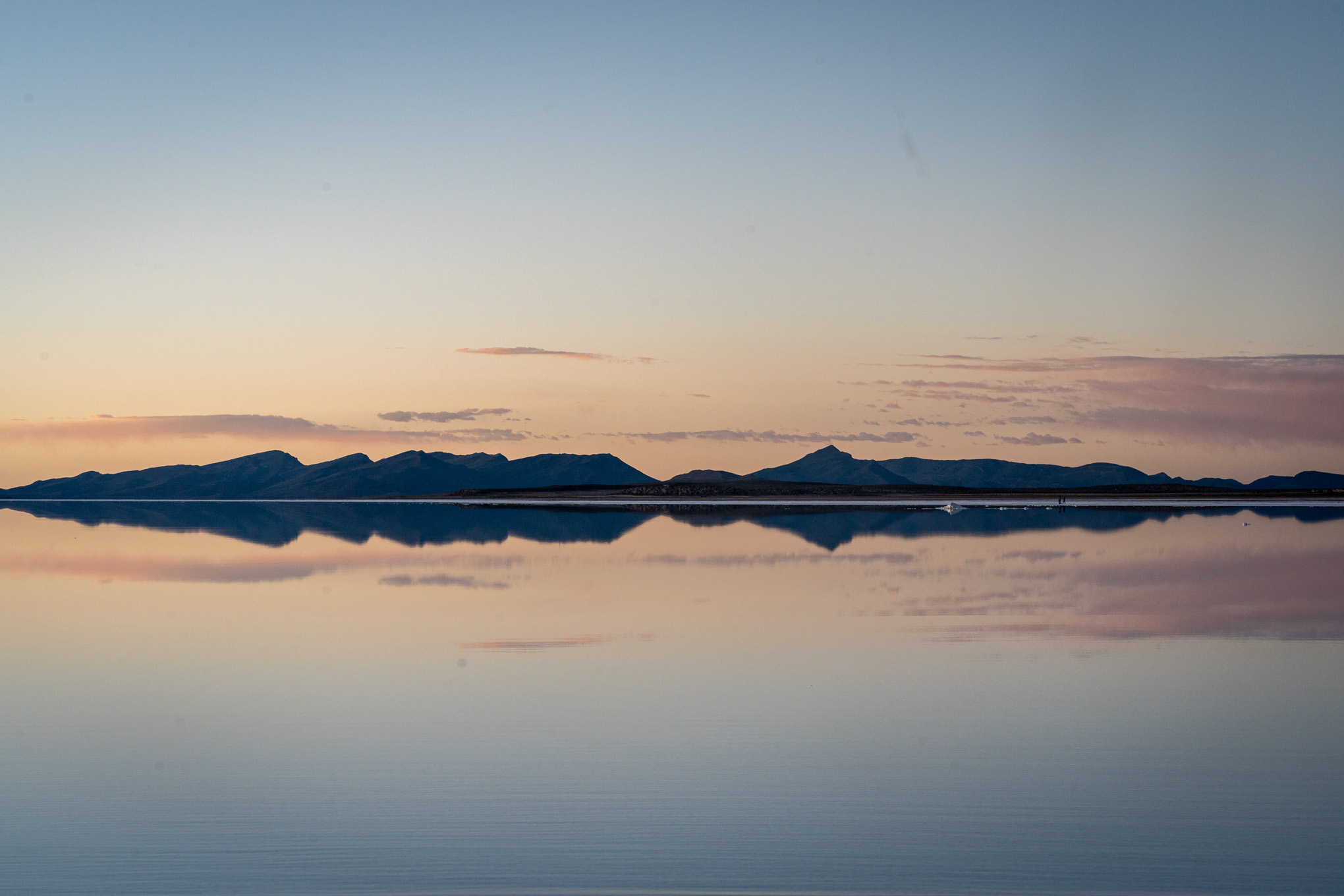
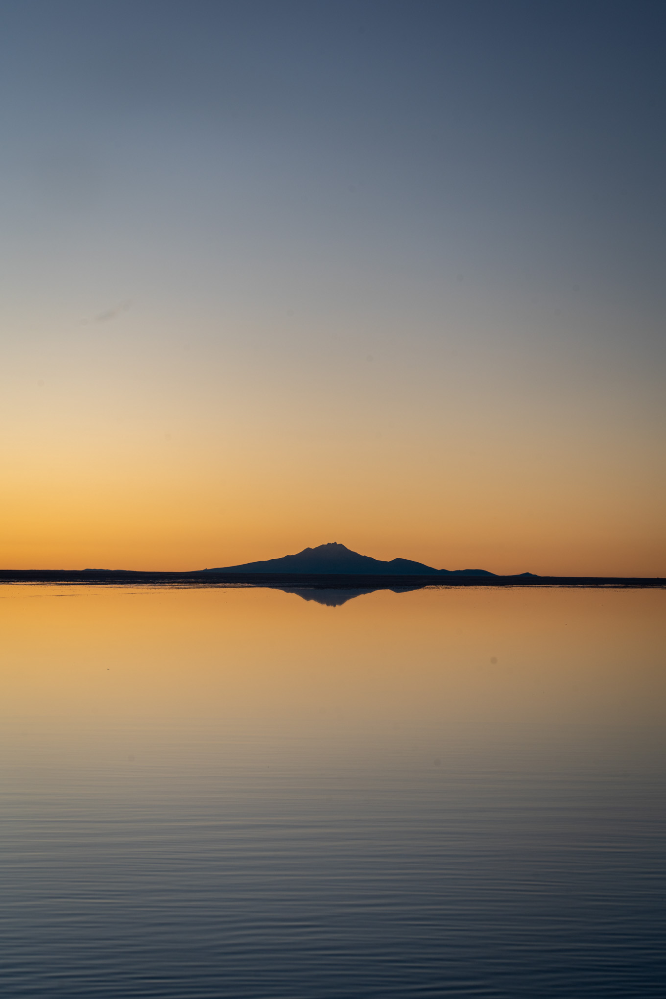
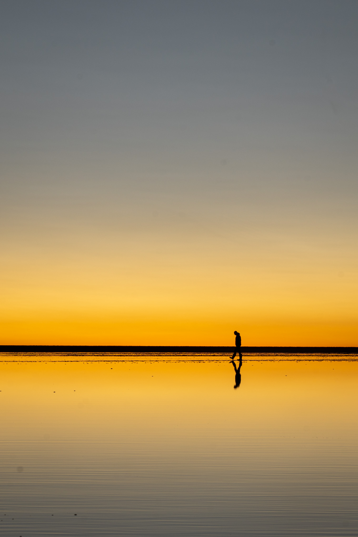
We had a bit too much time to kill, and therefore decided to return to the hotel to briefly freshen up. At 1800 we got back into the car for a sundowner over the salt plains. Unlike the sundowner in the Atacama desert, this one was truly amazing. As the sun went down slowly, were were able to admire its reflections over the thin layer of water. The light conditions were also perfect to see everything, from cars to people, perfectly reflected in the water when it was still. We enjoyed the atmosphere, and took a couple of pictures. In the height of tourism prior to corona, you would see up to 100 cars at this time. However, we were lucky to only have 20 or so. Once the sun disappeared from the horizon, and dusk turned into dark, we headed back to the Hotel. The best sunset of the trip was also our highlight in Uyuni, and is something that is hard to capture in pictures.
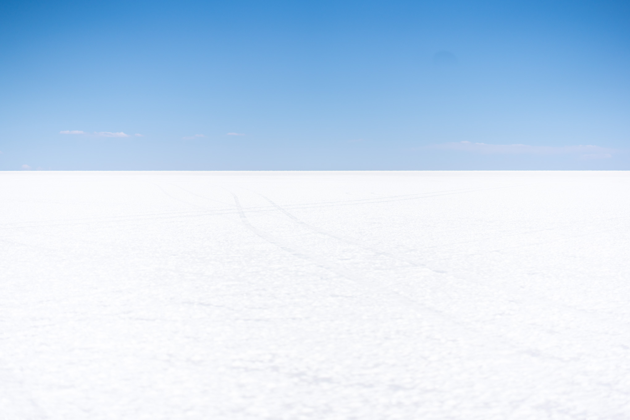
Salar de Uyuni is the world’s largest salt flat, or playa, at over 10,000 square kilometres (3,900 sq mi) in area. It is in the Daniel Campos Province in Potosí in southwest Bolivia, near the crest of the Andes at an elevation of 3,656 m (11,995 ft) above sea level.
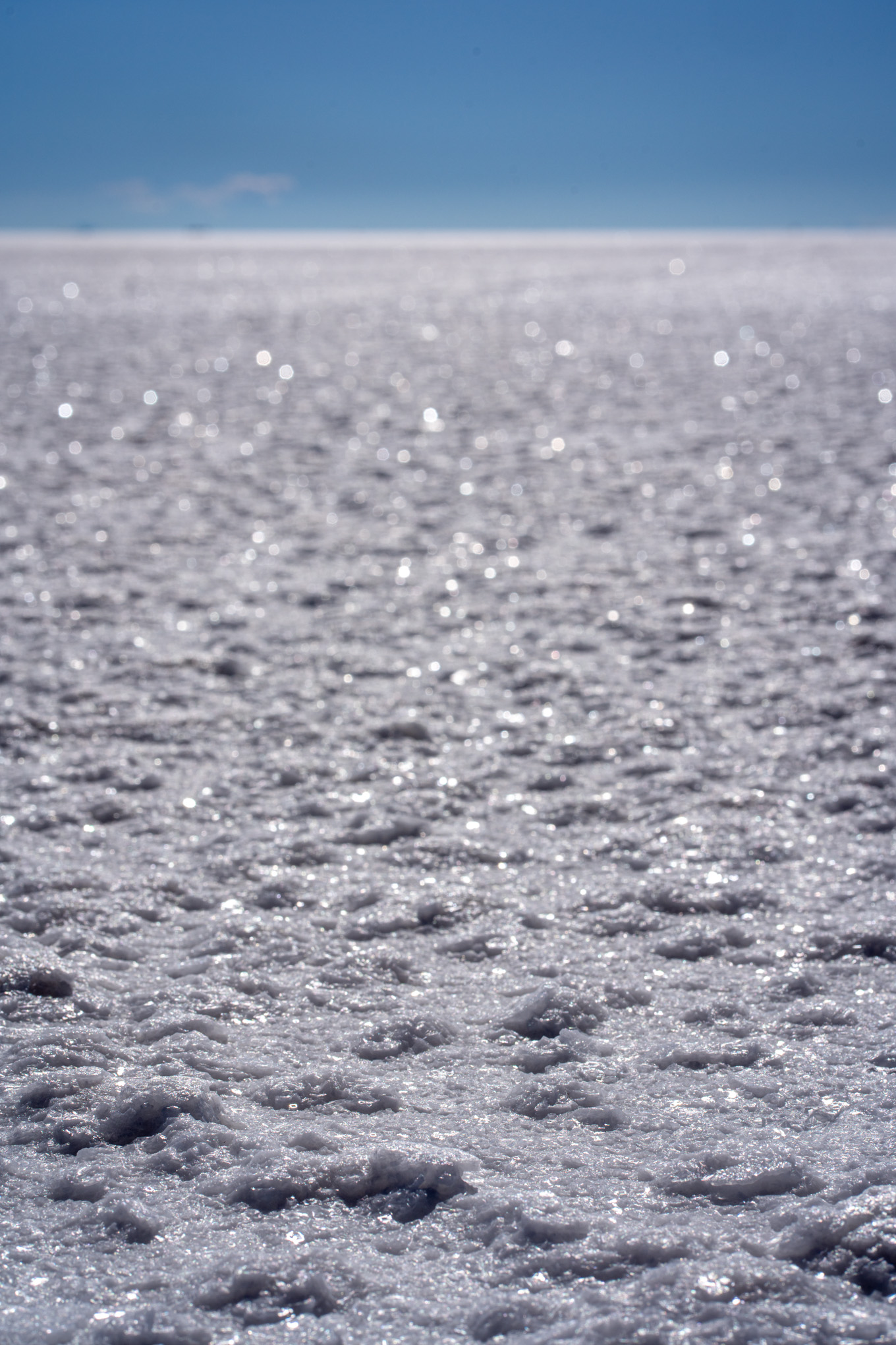
The Salar was formed as a result of transformations between several prehistoric lakes that existed around forty thousand years ago but had all evaporated over time. It is now covered by a few meters of salt crust, which has an extraordinary flatness with the average elevation variations within one meter over the entire area of the Salar. The crust serves as a source of salt and covers a pool of brine, which is exceptionally rich in lithium. The large area, clear skies, and exceptional flatness of the surface make the Salar ideal for calibrating the altimeters of Earth observation satellites. Following rain, a thin layer of dead calm water transforms the flat into the world’s largest mirror, 129 km (80 mi) across.
The Salar serves as the major transport route across the Bolivian Altiplano and is a prime breeding ground for several species of flamingos. Salar de Uyuni is also a climatological transitional zone since the towering tropical cumulus congestus and cumulonimbus incus clouds that form in the eastern part of the salt flat during the summer cannot permeate beyond its drier western edges, near the Chilean border and the Atacama Desert.
Reference: Wikipedia.org under https://en.wikipedia.org/wiki/Salar_de_Uyuni
Cochabamba is a city and municipality in central Bolivia in a valley in the Andes mountain range. It is the capital of the Cochabamba Department and the fourth largest city in Bolivia, with a population of 630,587 according to the 2012 Bolivian census. Its name is from a compound of the Quechua words qucha “lake” and pampa, “open plain.” Residents of the city and the surrounding areas are commonly referred to as cochalas or, more formally, cochabambinos. It is known as the “City of Eternal Spring” or “The Garden City” because of its spring-like temperatures all year round. It is also known as “La Llajta,” which means “town” in Quechua.
Reference: Wikipedia.org under https://en.wikipedia.org/wiki/Cochabamba
Bolivia is a landlocked country located in western-central South America. The constitutional capital is Sucre, while the seat of government and executive capital is La Paz. The largest city and principal industrial center is Santa Cruz de la Sierra, located on the Llanos Orientales (tropical lowlands), a mostly flat region in the east of the country.
The sovereign state of Bolivia is a constitutionally unitary state, divided into nine departments. Its geography varies from the peaks of the Andes in the West, to the Eastern Lowlands, situated within the Amazon basin. It is bordered to the north and east by Brazil, to the southeast by Paraguay, to the south by Argentina, to the southwest by Chile, and to the northwest by Peru. One-third of the country is within the Andean mountain range. With 1,098,581 km2 (424,164 sq mi) of area, Bolivia is the fifth largest country in South America, after Brazil, Argentina, Peru, and Colombia (and alongside Paraguay, one of the only two landlocked countries in the Americas), the 27th largest in the world, the largest landlocked country in the Southern Hemisphere, and the world’s seventh largest landlocked country, after Kazakhstan, Mongolia, Chad, Niger, Mali, and Ethiopia.
The country’s population, estimated at 11 million, is multiethnic, including Amerindians, Mestizos, Europeans, Asians, and Africans. Spanish is the official and predominant language, although 36 indigenous languages also have official status, of which the most commonly spoken are Guarani, Aymara, and Quechua languages.
Before Spanish colonization, the Andean region of Bolivia was part of the Inca Empire, while the northern and eastern lowlands were inhabited by independent tribes. Spanish conquistadors arriving from Cusco and Asunción took control of the region in the 16th century. During the Spanish colonial period Bolivia was administered by the Real Audiencia of Charcas. Spain built its empire in large part upon the silver that was extracted from Bolivia’s mines. After the first call for independence in 1809, 16 years of war followed before the establishment of the Republic, named for Simón Bolívar. Over the course of the 19th and early 20th century Bolivia lost control of several peripheral territories to neighboring countries including the seizure of its coastline by Chile in 1879. Bolivia remained relatively politically stable until 1971, when Hugo Banzer led a CIA-supported coup d’état which replaced the socialist government of Juan José Torres with a military dictatorship headed by Banzer; Torres was murdered in Buenos Aires, Argentina by a right-wing death squad in 1976. Banzer’s regime cracked down on left-wing and socialist opposition and other forms of dissent, resulting in the torture and deaths of a number of Bolivian citizens. Banzer was ousted in 1978 and later returned as the democratically elected president of Bolivia from 1997 to 2001.
Modern Bolivia is a charter member of the UN, IMF, NAM, OAS, ACTO, Bank of the South, ALBA, and USAN. Bolivia remains the second poorest country in South America, though it has slashed poverty rates and has the fastest growing economy in South America (in terms of GDP). It is a developing country, with a high ranking in the Human Development Index. Its main economic activities include agriculture, forestry, fishing, mining, and manufacturing goods such as textiles, clothing, refined metals, and refined petroleum. Bolivia is very rich in minerals, including tin, silver, lithium, and copper.
Reference: wikipedia.org under https://en.wikipedia.org/wiki/Bolivia